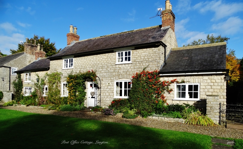
Latitude: 54.0942 / 54°5'39"N
Longitude: -0.7793 / 0°46'45"W
OS Eastings: 479934
OS Northings: 467167
OS Grid: SE799671
Mapcode National: GBR RP03.23
Mapcode Global: WHFBP.0C64
Plus Code: 9C6X36VC+M7
Entry Name: The Post Office
Listing Date: 10 October 1966
Last Amended: 11 February 1987
Grade: II
Source: Historic England
Source ID: 1149093
English Heritage Legacy ID: 328791
ID on this website: 101149093
Location: Langton, North Yorkshire, YO17
County: North Yorkshire
District: Ryedale
Civil Parish: Langton
Traditional County: Yorkshire
Lieutenancy Area (Ceremonial County): North Yorkshire
Church of England Parish: West Buckrose
Church of England Diocese: York
Tagged with: Post office
SE 76 NE
2/87
10.10.66
LANGTON
MAIN STREET
(east side, off)
The Post Office
(formerly listed as Tenement occupied by P G Frankish)
GV
II
House. Late C18. Hammer-dressed limestone, pantile roof. Direct end-entry
plan. 2 storeys, 2 first-floor windows. To left a 6-fielded-panel door
with glazed upper panel and two 2-light Yorkshire sashes and a casement to
right, all beneath keyed cambered arches. First floor: 2-light Yorkshire
sashes. Gable coping and shaped kneeler to right. Ridge stack.
Listing NGR: SE7993467167
External links are from the relevant listing authority and, where applicable, Wikidata. Wikidata IDs may be related buildings as well as this specific building. If you want to add or update a link, you will need to do so by editing the Wikidata entry.


Other nearby listed buildings