Latitude: 54.3025 / 54°18'9"N
Longitude: -0.9182 / 0°55'5"W
OS Eastings: 470494
OS Northings: 490195
OS Grid: SE704901
Mapcode National: GBR QL1P.0F
Mapcode Global: WHF9M.V3YY
Plus Code: 9C6X833J+2P
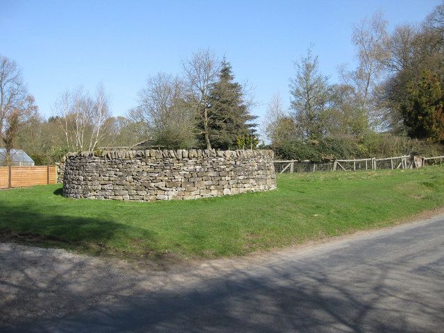
Entry Name: Pound
Listing Date: 24 June 1987
Grade: II
Source: Historic England
Source ID: 1149018
English Heritage Legacy ID: 328913
ID on this website: 101149018
Location: Hutton-le-Hole, North Yorkshire, YO62
County: North Yorkshire
District: Ryedale
Civil Parish: Hutton-le-Hole
Traditional County: Yorkshire
Lieutenancy Area (Ceremonial County): North Yorkshire
Church of England Parish: Lastingham St Mary
Church of England Diocese: York
Tagged with: Animal pound
SE 7090
SE 7089
11/77
HUTTON-LE-HOLE
MOOR LANE
(north-west side)
Pound
II
Pound. Probably late C17. Limestone rubble. Circular on plan. Wall
approximately 1.75 metres to 2 metres high with vertically set coping
stones. Gateway to west.
Listing NGR: SE7049490195
External links are from the relevant listing authority and, where applicable, Wikidata. Wikidata IDs may be related buildings as well as this specific building. If you want to add or update a link, you will need to do so by editing the Wikidata entry.


Other nearby listed buildings