Latitude: 54.5059 / 54°30'21"N
Longitude: -0.694 / 0°41'38"W
OS Eastings: 484661
OS Northings: 513074
OS Grid: NZ846130
Mapcode National: GBR RJLB.JJ
Mapcode Global: WHG9X.90RJ
Plus Code: 9C6XG844+99
Entry Name: Oakdene
Listing Date: 10 December 1985
Grade: II
Source: Historic England
Source ID: 1148865
English Heritage Legacy ID: 327281
ID on this website: 101148865
NZ 8413 LYTHE HIGH STREET (north side) Lythe 13/206 Oakdene -
- II
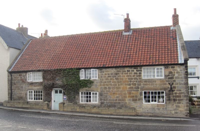
House, late C17 with alterations. Coursed squared stone. Pantiled roof with stone copings. Brick chimneys. Two storeys, 3 windows, wide proportions. C20 Yorkshire sashes and a small early C19 shop window. Two blocked, stepped and chamfered stone-mullioned windows in end wall.
Listing NGR: NZ8466113074
External links are from the relevant listing authority and, where applicable, Wikidata. Wikidata IDs may be related buildings as well as this specific building. If you want to add or update a link, you will need to do so by editing the Wikidata entry.


Other nearby listed buildings