Latitude: 54.4586 / 54°27'30"N
Longitude: -0.9609 / 0°57'39"W
OS Eastings: 467457
OS Northings: 507515
OS Grid: NZ674075
Mapcode National: GBR PJQW.RH
Mapcode Global: WHF8V.66NB
Plus Code: 9C6XF25Q+CJ
Entry Name: 8 Boundary Stones on Border with Westerdale Counry Parish
Listing Date: 20 December 1990
Grade: II
Source: Historic England
Source ID: 1148606
English Heritage Legacy ID: 327970
ID on this website: 101148606
Location: North Yorkshire, YO21
County: North Yorkshire
District: Scarborough
Civil Parish: Danby
Traditional County: Yorkshire
Lieutenancy Area (Ceremonial County): North Yorkshire
Church of England Parish: Danby with Castleton and Commondale
Church of England Diocese: York
Tagged with: Building Boundary marker
This list entry was subject to a Minor Amendment on 10 February 2025 to correct a typo in the Name and Address and to reformat the text to current standards
NZ 60 NE
6736-0740 to 6790-0753
6/52
DANBY
HARE SLACK
Eight Boundary Stones on border with Westerdale County Parish
II
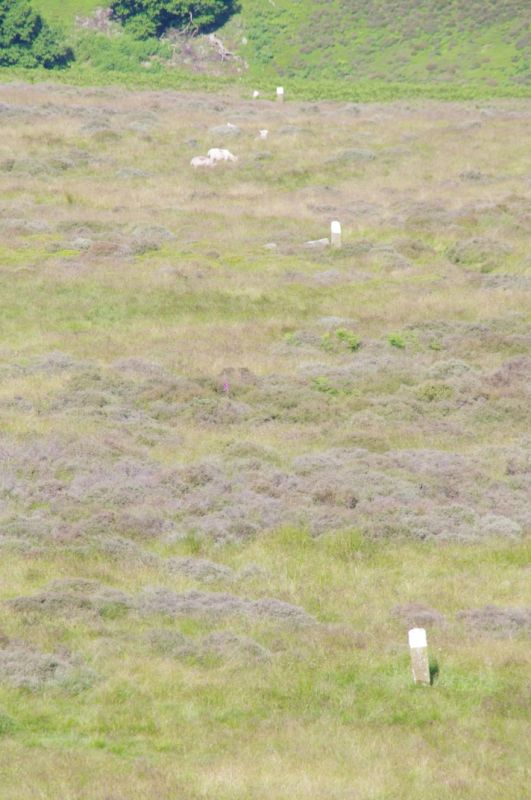
Angled row of eight boundary stones. Circa 1835. Hard sandstone. Square stones about 1 m. high with roughly-rounded tops; inscribed on north face D (for Danby) and on south face W (for Westerdale). Whitewashed tops. These stones mark the line where the boundary runs west from Gallow How to join the Esk river at its confluence with the Hob Hole Beck.
Listing NGR: NZ6745707515
External links are from the relevant listing authority and, where applicable, Wikidata. Wikidata IDs may be related buildings as well as this specific building. If you want to add or update a link, you will need to do so by editing the Wikidata entry.


Other nearby listed buildings