Latitude: 53.0601 / 53°3'36"N
Longitude: -0.693 / 0°41'34"W
OS Eastings: 487691
OS Northings: 352229
OS Grid: SK876522
Mapcode National: GBR CLZ.5MH
Mapcode Global: WHGJW.BB8W
Plus Code: 9C5X3864+3R
Entry Name: Sutton Lane Farmhouse
Listing Date: 17 June 1986
Grade: II
Source: Historic England
Source ID: 1147485
English Heritage Legacy ID: 192371
ID on this website: 101147485
Location: Sutton, North Kesteven, Lincolnshire, LN5
County: Lincolnshire
District: North Kesteven
Civil Parish: Beckingham
Traditional County: Lincolnshire
Lieutenancy Area (Ceremonial County): Lincolnshire
Church of England Parish: Beckingham All Saints
Church of England Diocese: Lincoln
Tagged with: Farmhouse
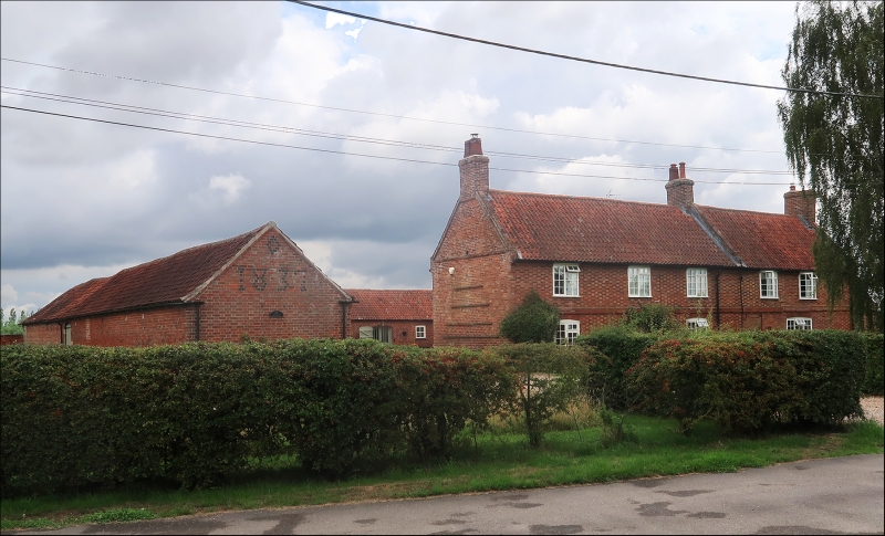
BECKINGHAM SUTTON LANE SK 85 SE (south side) 5/20 Sutton Lane Farmhouse - GV II Farmhouse. c1800. Red brick stretchers with white brick headers. Pantile roof, with brick coped gables with kneelers and 3 brick gable stacks. First floor band and dentilated eaves. 3 bay main house with 2 bay section to south. Main house has central doorway with C20 panel door, flanked by single C20 glazing bar casements, above 3 similar windows all with segment heads, to south a single large C20 window on the ground floor with 2, C20 glazing bar casements above each with a segment head.
Listing NGR: SK8769152229
External links are from the relevant listing authority and, where applicable, Wikidata. Wikidata IDs may be related buildings as well as this specific building. If you want to add or update a link, you will need to do so by editing the Wikidata entry.


Other nearby listed buildings