Latitude: 53.3651 / 53°21'54"N
Longitude: -0.0065 / 0°0'23"W
OS Eastings: 532746
OS Northings: 387210
OS Grid: TF327872
Mapcode National: GBR XYDJ.DF
Mapcode Global: WHHJS.WP23
Plus Code: 9C5X9X8V+2C
Entry Name: 40 and 42, Upgate
Listing Date: 18 February 1974
Grade: II
Source: Historic England
Source ID: 1146786
English Heritage Legacy ID: 195040
ID on this website: 101146786
Location: Louth, East Lindsey, Lincolnshire, LN11
County: Lincolnshire
District: East Lindsey
Civil Parish: Louth
Built-Up Area: Louth
Traditional County: Lincolnshire
Lieutenancy Area (Ceremonial County): Lincolnshire
Church of England Parish: Louth
Church of England Diocese: Lincoln
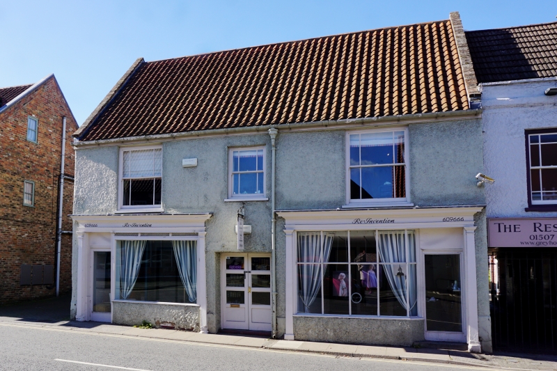
UPGATE 1. 1348 (West Side) Nos 40 & 42 TF 38 NW 1/244 II GV 2. C18 origin. 2 storeys. Rough rendered. Pantile roof. 3 windows, centre one smaller, marginal glazing. 2 Cl9 shop fronts with plain pilasters. Tiled stall riser with name 'Blacksmith'. Centre modern door, flat arch. Listed solely as part of a group. Nos 36 to 52 (even) form a group.
Listing NGR: TF3274687210
External links are from the relevant listing authority and, where applicable, Wikidata. Wikidata IDs may be related buildings as well as this specific building. If you want to add or update a link, you will need to do so by editing the Wikidata entry.


Other nearby listed buildings