Latitude: 52.9371 / 52°56'13"N
Longitude: -0.5198 / 0°31'11"W
OS Eastings: 499580
OS Northings: 338773
OS Grid: SK995387
Mapcode National: GBR FR7.TP3
Mapcode Global: WHGKJ.ZFNP
Plus Code: 9C4XWFPJ+V3
Entry Name: Oasby Mill
Listing Date: 20 September 1984
Grade: II
Source: Historic England
Source ID: 1146543
English Heritage Legacy ID: 193237
ID on this website: 101146543
Location: Oasby, South Kesteven, Lincolnshire, NG32
County: Lincolnshire
District: South Kesteven
Civil Parish: Heydour
Traditional County: Lincolnshire
Lieutenancy Area (Ceremonial County): Lincolnshire
Church of England Parish: Ancaster Wilsford Group
Church of England Diocese: Lincoln
Tagged with: Mill
SK 93 NE
2/22
HEYDOUR
MILL LANE (north side)
Oasby
Oasby Mill
II
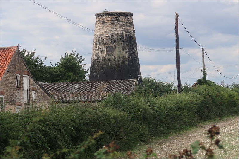
Tower windmill; 1810; black bitumen painted ashlar with top in coursed
limestone rubble. A 2 storey circular tapering tower with cap and sails
removed, having slight plinth and corbelled out band to top of tower.
It has a plain wooden door and 2 blocked openings above. Inside the 2 floors
are intact but all machinery removed.
Listing NGR: SK9958038773
External links are from the relevant listing authority and, where applicable, Wikidata. Wikidata IDs may be related buildings as well as this specific building. If you want to add or update a link, you will need to do so by editing the Wikidata entry.


Other nearby listed buildings