Latitude: 53.2635 / 53°15'48"N
Longitude: -1.8146 / 1°48'52"W
OS Eastings: 412460
OS Northings: 374068
OS Grid: SK124740
Mapcode National: GBR HZRP.XV
Mapcode Global: WHCCZ.374H
Plus Code: 9C5W757P+94
Entry Name: Wormhill Hall
Listing Date: 25 October 1951
Grade: II*
Source: Historic England
Source ID: 1146377
English Heritage Legacy ID: 82312
ID on this website: 101146377
Location: Wormhill, High Peak, Derbyshire, SK17
County: Derbyshire
District: High Peak
Civil Parish: Wormhill
Traditional County: Derbyshire
Lieutenancy Area (Ceremonial County): Derbyshire
Church of England Parish: Tideswell St John the Baptist
Church of England Diocese: Derby
Tagged with: House
SK 17 SW PARISH OF WORMHILL 5/53 25.10.1951 Wormhill Hall GV II*
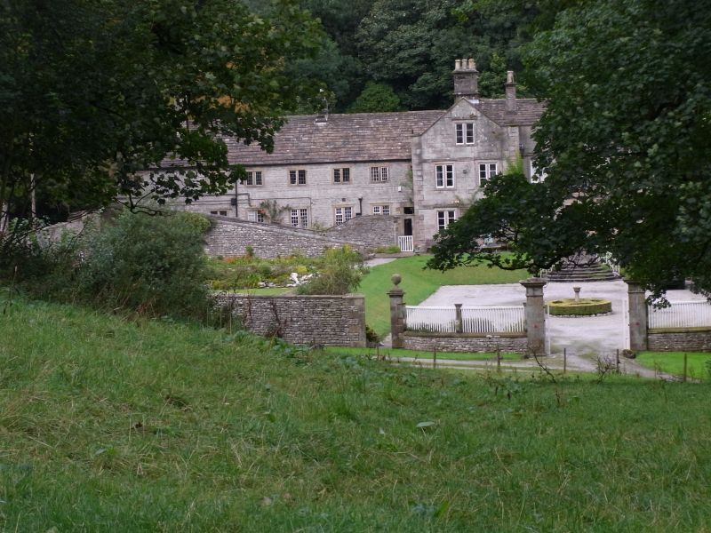
Small country house. Dated on rainwater heads 'B AA 1697'. Ashlar gritstone with projecting quoins, moulded copings and kneelers, ashlar ridge stacks and single side wall stack, mostly with moulded caps. Irregular 'H' plan. South west elevation two storeys and attics, seven bays with advanced two bay gabled crosswings, and central range with parapet. 2-light flush mullioned windows with slightly projecting surrounds and with plain hoods integral with continuous flat bands which link the heads of ground and first floor windows. C19 casements with horizontal glazing bars. Central doorway with moulded doorcase and segmental pediment. C19 nine panelled door with upper six panels glazed. Rainwater heads to junctions of main range and crosswings bear the dated inscription. Interior: C17 and C18 panelling to ground and first floor rooms. Principal stair - a good full height turned baluster example, with contemporary decorative plastwork to stairwell ceiling. Setting: small formal gardens, now overgrown, to the south and south east.
Listing NGR: SK1246074068
External links are from the relevant listing authority and, where applicable, Wikidata. Wikidata IDs may be related buildings as well as this specific building. If you want to add or update a link, you will need to do so by editing the Wikidata entry.


Other nearby listed buildings