Latitude: 51.0421 / 51°2'31"N
Longitude: -2.1548 / 2°9'17"W
OS Eastings: 389241
OS Northings: 126982
OS Grid: ST892269
Mapcode National: GBR 1X5.N15
Mapcode Global: FRA 66CC.J9Z
Plus Code: 9C3V2RRW+R3
Entry Name: Church Farmhouse
Listing Date: 6 July 1987
Grade: II
Source: Historic England
Source ID: 1146049
English Heritage Legacy ID: 320973
ID on this website: 101146049
Location: Semley, Wiltshire, SP7
County: Wiltshire
Civil Parish: Sedgehill and Semley
Traditional County: Wiltshire
Lieutenancy Area (Ceremonial County): Wiltshire
Church of England Parish: Semley St Leonard
Church of England Diocese: Salisbury
Tagged with: Farmhouse
SEMLEY SEMLEY VILLAGE ST 82 NE (north side)
3/183 Church Farmhouse
GV II
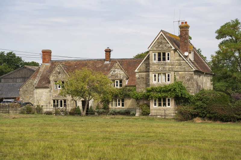
Farmhouse. C16 with C17 wing, altered late C19. Rubble stone and dressed limestone, tiled roof, brick stacks. Through passage to rear of stack. Single-storey and attic, 2-window earlier range. Central gabled porch wth 4-panelled door in elliptically-headed doorway, single chamfered fire window to left and 4-light recessed chamfered mullioned casement either side of porch. Two full gabled dormers have 3-light mullioned casements. Left return has blocked pointed doorway and fragments of string course over. C17 cross range to right has 3-light recessed chamfered mullioned casement to ground and first floor and string course on left return, gable end has C19 three-storey square bay with 4-light mullioned casements, right return of wing has central 3-panelled door with 3-light mullioned casement with hoodmould either side and single light casement with 3-light mullioned casement left and right to first floor, gabled dormer to roof. Rear has 6-panelled door and 3-light muliioned casement with 2-light attic casement to main range, wing, has 2-light mullioned casements. Interior largely inaccessible, but through passage has fine strap- work panelling on left side, deeply chamfered beams, open fireplaces with chamfered lintels on stone jambs. Possibly a Medieval house remodelled and extended in the C17.
Listing NGR: ST8924126982
External links are from the relevant listing authority and, where applicable, Wikidata. Wikidata IDs may be related buildings as well as this specific building. If you want to add or update a link, you will need to do so by editing the Wikidata entry.


Other nearby listed buildings