Latitude: 54.5349 / 54°32'5"N
Longitude: -1.6757 / 1°40'32"W
OS Eastings: 421080
OS Northings: 515559
OS Grid: NZ210155
Mapcode National: GBR JJR0.04
Mapcode Global: WHC5V.789V
Plus Code: 9C6WG8MF+WP
Entry Name: Piercebridge Bridge
Listing Date: 6 June 1952
Grade: II*
Source: Historic England
Source ID: 1145843
English Heritage Legacy ID: 110880
ID on this website: 101145843
Location: Cliffe, Darlington, County Durham, DL2
County: Darlington
Civil Parish: Piercebridge
Traditional County: Durham
Lieutenancy Area (Ceremonial County): County Durham
Church of England Parish: Coniscliffe
Church of England Diocese: Durham
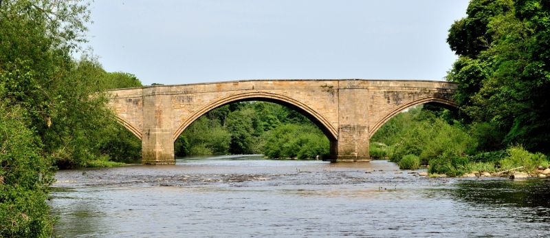
NZ 2115 PIERCEBRIDGE B6275 17/151 Piercebridge Bridge 6/6/52 II* Road bridge over River Tees. Early C16, widened on downstream side in 1781 (plaque dated 1673 no longer legible). Dressed and ashlar sandstone. Upstream side: 3 wide arches of 2 stepped orders. Segmental central arch and slightly-pointed flanking arches. Stepped triangular-plan cutwaters, flanking central arch, rise to form pedestrian refuges. Parapet, slightly-raked either side of centre, has band at road level and chamfered coping. Segmental relieving arch supports parapet at north end. Downstream face: similar cutwaters flanking central arch; arches are segmental with roll-moulded arch bands. Splayed north end walls and curving south end walls; cylindrical end piers. This bridge straddles the parishes of Piercebridge and Cliffe, North Yorkshire. Scheduled Ancient Monument. (E. Jervoise, The Ancient Bridges of the North of England, 1973).
Listing NGR: NZ2108015559


Other nearby listed buildings