Latitude: 54.8248 / 54°49'29"N
Longitude: -2.8692 / 2°52'9"W
OS Eastings: 344251
OS Northings: 548116
OS Grid: NY442481
Mapcode National: GBR 8DDN.M7
Mapcode Global: WH809.WZWM
Plus Code: 9C6VR4FJ+W8
Entry Name: Crook's Bridge
Listing Date: 24 October 1986
Grade: II
Source: Historic England
Source ID: 1145481
English Heritage Legacy ID: 73929
ID on this website: 101145481
Location: Birkthwaite, Westmorland and Furness, Cumbria, CA4
County: Westmorland and Furness
District: Eden
Civil Parish: Hesket
Traditional County: Cumberland
Lieutenancy Area (Ceremonial County): Cumbria
Church of England Parish: Wreay St Mary
Church of England Diocese: Carlisle
Tagged with: Bridge
NY 44 NW HESKET WREAY
1/200 Crook's Bridge
II
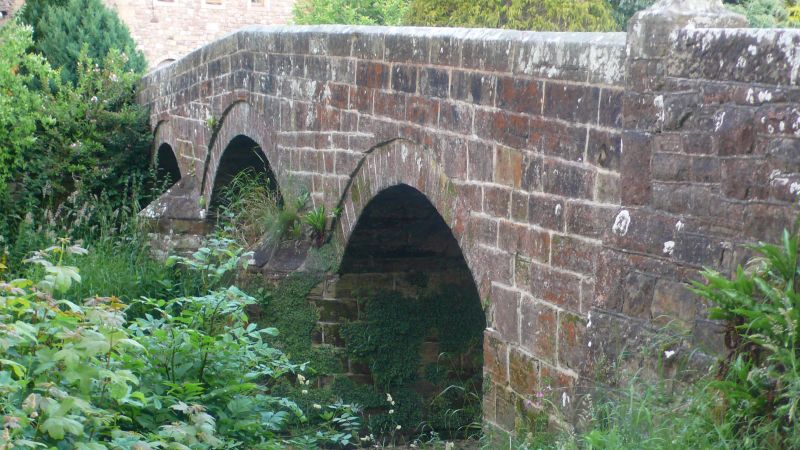
Roadbridge. Early C19. Mixed blocks of red and calciferous sandstone. 3 segmental arches on splayed cutwater piers, under solid chamfered parapet ending in square piers with shaped caps.
Listing NGR: NY4425148116
External links are from the relevant listing authority and, where applicable, Wikidata. Wikidata IDs may be related buildings as well as this specific building. If you want to add or update a link, you will need to do so by editing the Wikidata entry.


Other nearby listed buildings