Latitude: 54.7032 / 54°42'11"N
Longitude: -3.3201 / 3°19'12"W
OS Eastings: 315027
OS Northings: 535043
OS Grid: NY150350
Mapcode National: GBR 5G71.ZT
Mapcode Global: WH6ZQ.Z14S
Plus Code: 9C6RPM3H+7W
Entry Name: High Farmhouse and Barn Adjoining
Listing Date: 5 September 1986
Grade: II
Source: Historic England
Source ID: 1145215
English Heritage Legacy ID: 72544
ID on this website: 101145215
Location: Blindcrake, Cumberland, Cumbria, CA13
County: Cumberland
District: Allerdale
Civil Parish: Blindcrake
Traditional County: Cumberland
Lieutenancy Area (Ceremonial County): Cumbria
Church of England Parish: Binsey Team
Church of England Diocese: Carlisle
Tagged with: Farmhouse
BLINDCRAKE BLINDCRAKE NY 13 NE 3/19 High Farmhouse and barn adjoining II
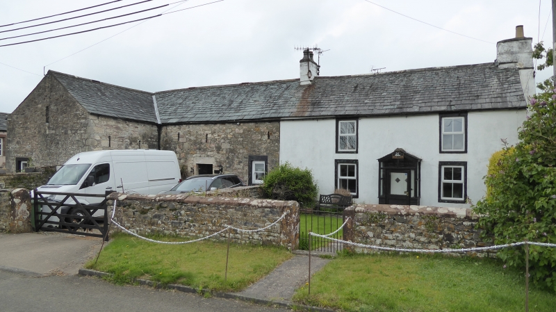
Farmhouse and barn. Dated and inscribed over entrance 1730 JOHN AND MARTHA BLAICKLIN, with C20 alterations. Incised rendered walls, under graduated greenslate roof with painted rendered chimney stacks, that to right a projecting gable stack. Barn of mixed calciferous sandstone and boulder rubble. 2 storeys, 2 bays, with left barn under common roof and front right-angled barn extension. Panelled door in painted stone architrave within C20 porch. C20 casement windows in original C18 painted stone surrounds. Barn has plank door in alternate-block surround, and flanking casement windows, all under slit vents. Extension has similar doorway and window under slit vents. Wooden lean-to sheds are not of interest.
Listing NGR: NY1502735043
External links are from the relevant listing authority and, where applicable, Wikidata. Wikidata IDs may be related buildings as well as this specific building. If you want to add or update a link, you will need to do so by editing the Wikidata entry.


Other nearby listed buildings