Latitude: 54.7164 / 54°42'59"N
Longitude: -3.4904 / 3°29'25"W
OS Eastings: 304085
OS Northings: 536734
OS Grid: NY040367
Mapcode National: GBR 4F2X.42
Mapcode Global: WH5YB.CQ35
Plus Code: 9C6RPG85+HR
Entry Name: Lodge at Netherhall
Listing Date: 27 May 1977
Grade: II
Source: Historic England
Source ID: 1144644
English Heritage Legacy ID: 71847
ID on this website: 101144644
Location: Netherton, Cumberland, Cumbria, CA15
County: Cumberland
District: Allerdale
Civil Parish: Maryport
Built-Up Area: Maryport
Traditional County: Cumberland
Lieutenancy Area (Ceremonial County): Cumbria
Church of England Parish: Maryport St Mary with Christ Church
Church of England Diocese: Carlisle
Tagged with: Gatehouse
MARYPORT NETHERHALL ROAD 1. 5161 (South-East Side) ----------------- Lodge at Netherhall NY 03 NW 3/4 II GV
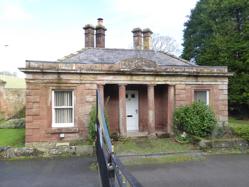
2. Early C19. 1 storey in tooled red sandstone with rusticated quoins and hipped Welsh slate roof. 2 windows with moulded surrounds. 4-column Roman Doric portico with moulded entablature. Paired diagonal-set chimney stacks. Derelict at time of survey (1976).
Listing NGR: NY0408536734
External links are from the relevant listing authority and, where applicable, Wikidata. Wikidata IDs may be related buildings as well as this specific building. If you want to add or update a link, you will need to do so by editing the Wikidata entry.


Other nearby listed buildings