Latitude: 50.1185 / 50°7'6"N
Longitude: -5.4774 / 5°28'38"W
OS Eastings: 151511
OS Northings: 30065
OS Grid: SW515300
Mapcode National: GBR DXVC.HV5
Mapcode Global: VH130.08NZ
Plus Code: 9C2P4G9F+C2
Entry Name: St Aubyn Arms (West Wing)
Listing Date: 9 October 1987
Grade: II
Source: Historic England
Source ID: 1143790
English Heritage Legacy ID: 69958
ID on this website: 101143790
Location: Marazion, Cornwall, TR17
County: Cornwall
Civil Parish: St. Michael's Mount
Traditional County: Cornwall
Lieutenancy Area (Ceremonial County): Cornwall
Tagged with: Architectural structure
MARAZION ST MICHAEL'S MOUNT SW 5130 4/48 St Aubyn Arms (west wing)
GV II
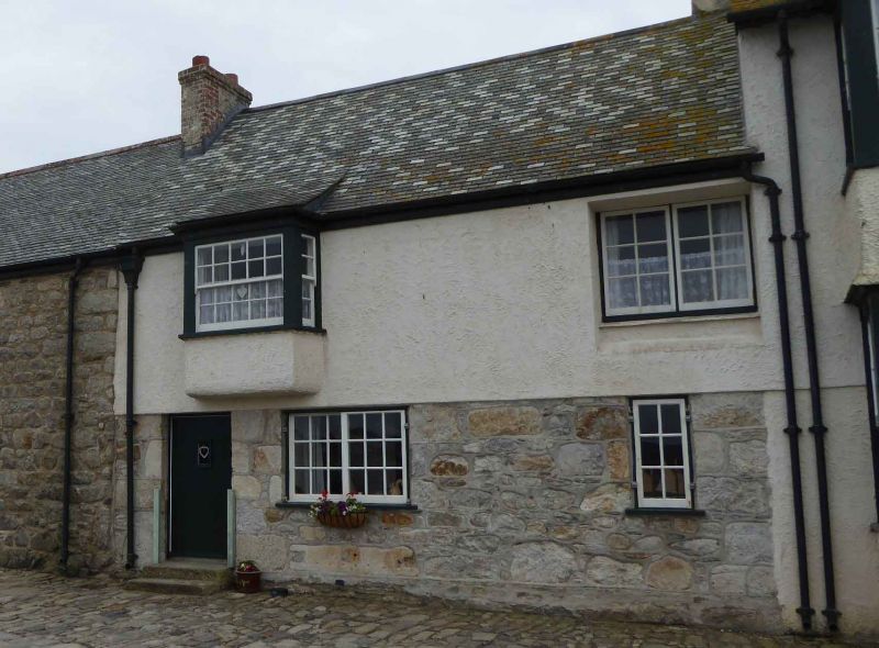
House, formerly part of public house (until 1902). Probably C18. Painted rubble walls to ground floor, rendered above, possibly over cob. Grouted dry Delabole slate roof with shared chimneys over party walls. Cast-iron ogee gutters. Plan: double depth plan with cross or through passage on the left, large front room middle and possibly small room right. Exterior : 2 storeys. Irregular 2 window north front with doorway on the left. Ledged door. Old 18-pane horizontal-sliding sash left of middle and narrow 6-pane casement right. Over the pier between the doorway and window is a canted oriel window with probably C20 sashes with glazing bars and in a square opening to first floor, far right is a C20 12-pane 2-light casement. Under the wide ground floor window is a reused granite monolith with trenched ends. Interior not inspected.
Listing NGR: SW5151030063
External links are from the relevant listing authority and, where applicable, Wikidata. Wikidata IDs may be related buildings as well as this specific building. If you want to add or update a link, you will need to do so by editing the Wikidata entry.


Other nearby listed buildings