Latitude: 50.1312 / 50°7'52"N
Longitude: -5.4275 / 5°25'38"W
OS Eastings: 155146
OS Northings: 31302
OS Grid: SW551313
Mapcode National: GBR DXZB.GPM
Mapcode Global: VH12T.WY2V
Plus Code: 9C2P4HJF+F2
Entry Name: The Jolly Tinners
Listing Date: 9 October 1987
Grade: II
Source: Historic England
Source ID: 1143754
English Heritage Legacy ID: 70067
ID on this website: 101143754
Location: St Hilary, Cornwall, TR20
County: Cornwall
Civil Parish: St. Hilary
Traditional County: Cornwall
Lieutenancy Area (Ceremonial County): Cornwall
Church of England Parish: St Hilary
Church of England Diocese: Truro
Tagged with: Architectural structure
ST HILARY CHURCHTOWN, St Hilary SW 53 SE 2/163 The Jolly Tinners
GV II
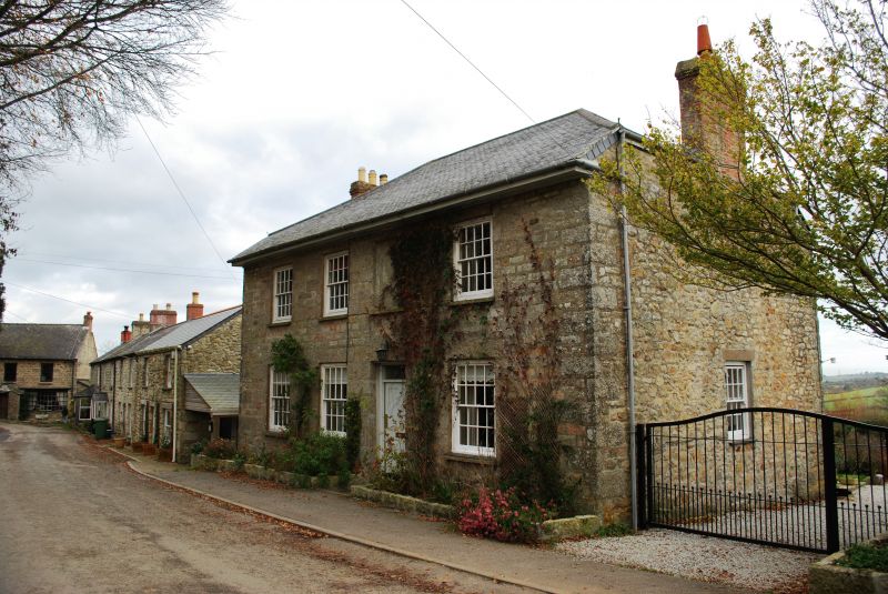
House, later an inn and for a time in circa the early 1900's used as a home for destitute children. Circa early-mid C19 with granite dressings. Half-hipped grouted scantle slate roof with brick chimneys over the side walls. Plan: double depth plan : 2 front rooms, the left hand room wider; passage between leading to stair hall, rear left of middle; kitchen behind the right hand room; pantry at rear left and shallow room (possibly butler's pantry) between the left hand front and rear rooms. The front chambers have formerly sliding partitions between probably inserted for use as a dormitory when used as a children's home. Exterior : 2 storeys. Regular 4 window south front with doorway under the third from left first floor (blind) window opening. Original hornless 16-pane sashes at the front and at the rear. C20 doors. Interior : little altered since built with mostly original carpentry and joinery including 6-panel doors and arch between entrance passage and stair hall. Stairs renewed C20.
Listing NGR: SW5514631302
External links are from the relevant listing authority and, where applicable, Wikidata. Wikidata IDs may be related buildings as well as this specific building. If you want to add or update a link, you will need to do so by editing the Wikidata entry.


Other nearby listed buildings