Latitude: 50.1066 / 50°6'23"N
Longitude: -5.5494 / 5°32'58"W
OS Eastings: 146301
OS Northings: 28985
OS Grid: SW463289
Mapcode National: GBR DXPD.DV0
Mapcode Global: VH05H.RLL3
Plus Code: 9C2P4F42+M6
Entry Name: Old Bridge
Listing Date: 7 February 1974
Grade: II
Source: Historic England
Source ID: 1143197
English Heritage Legacy ID: 69359
ID on this website: 101143197
Location: Newlyn, Cornwall, TR18
County: Cornwall
Civil Parish: Penzance
Built-Up Area: Newlyn
Traditional County: Cornwall
Lieutenancy Area (Ceremonial County): Cornwall
Church of England Parish: Newlyn
Church of England Diocese: Truro
Tagged with: Bridge
1. 1498 NEWLYN FLORENCE PLACE
Old Bridge SW 42 NE 8/399 SW 42 SE 8/399
II
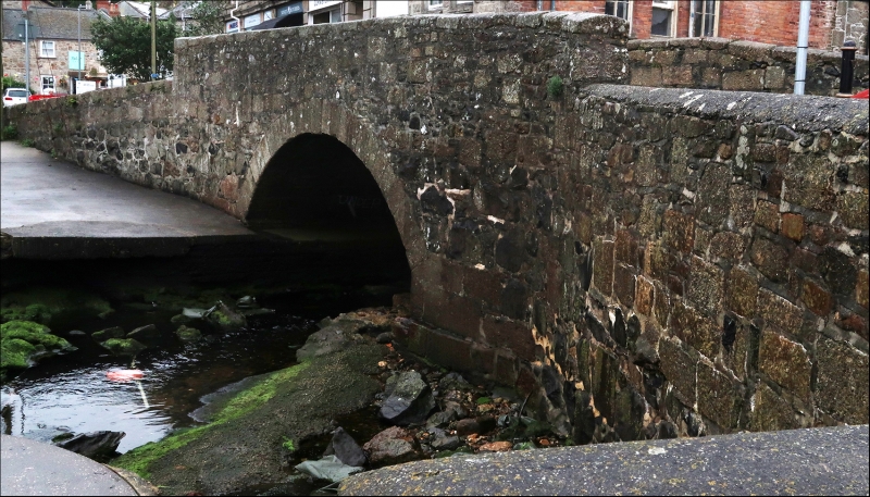
2. Probably early C19. Granite. Single segmental arch with keyblock. Parapet.
Listing NGR: SW4630528989
External links are from the relevant listing authority and, where applicable, Wikidata. Wikidata IDs may be related buildings as well as this specific building. If you want to add or update a link, you will need to do so by editing the Wikidata entry.


Other nearby listed buildings