Latitude: 50.2161 / 50°12'57"N
Longitude: -5.1989 / 5°11'56"W
OS Eastings: 171883
OS Northings: 40018
OS Grid: SW718400
Mapcode National: GBR Z4.RKFS
Mapcode Global: FRA 080G.6D5
Plus Code: 9C2P6R82+CC
Entry Name: Oak Villa
Listing Date: 12 September 1989
Grade: II
Source: Historic England
Source ID: 1142574
English Heritage Legacy ID: 66774
ID on this website: 101142574
Location: Lanner, Cornwall, TR16
County: Cornwall
Civil Parish: Lanner
Built-Up Area: Lanner
Traditional County: Cornwall
Lieutenancy Area (Ceremonial County): Cornwall
Church of England Parish: Lanner
Church of England Diocese: Truro
Tagged with: Villa
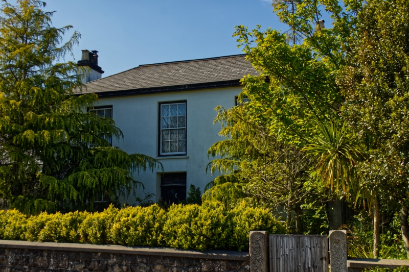
LANNER LANNER HILL SW 74 SW (north side) 6/218 Oak Villa GV II House. Probably mid to later C19. White painted render with granite quoins, slate roof. Double-depth plan. Two storeys and 3 bays, symmetrical; central doorway with altered door and low overlight lettered "OAK VILLA", 12-pane sashed windows; hipped roof with projecting eaves, side-wall chimneys. Rear and interior not inspected. Has group value with Glyn Garth next door but one to the right (q.v.).
Listing NGR: SW7188340018
External links are from the relevant listing authority and, where applicable, Wikidata. Wikidata IDs may be related buildings as well as this specific building. If you want to add or update a link, you will need to do so by editing the Wikidata entry.


Other nearby listed buildings