Latitude: 50.2378 / 50°14'15"N
Longitude: -5.2387 / 5°14'19"W
OS Eastings: 169147
OS Northings: 42550
OS Grid: SW691425
Mapcode National: GBR Z3.D0ZC
Mapcode Global: VH12K.49V2
Plus Code: 9C2P6QQ6+4G
Entry Name: Foundry House
Listing Date: 12 September 1989
Grade: II
Source: Historic England
Source ID: 1142538
English Heritage Legacy ID: 66874
ID on this website: 101142538
Location: Plain-an-Gwarry, Cornwall, TR15
County: Cornwall
Civil Parish: Redruth
Built-Up Area: Redruth
Traditional County: Cornwall
Lieutenancy Area (Ceremonial County): Cornwall
Church of England Parish: Redruth
Church of England Diocese: Truro
Tagged with: House
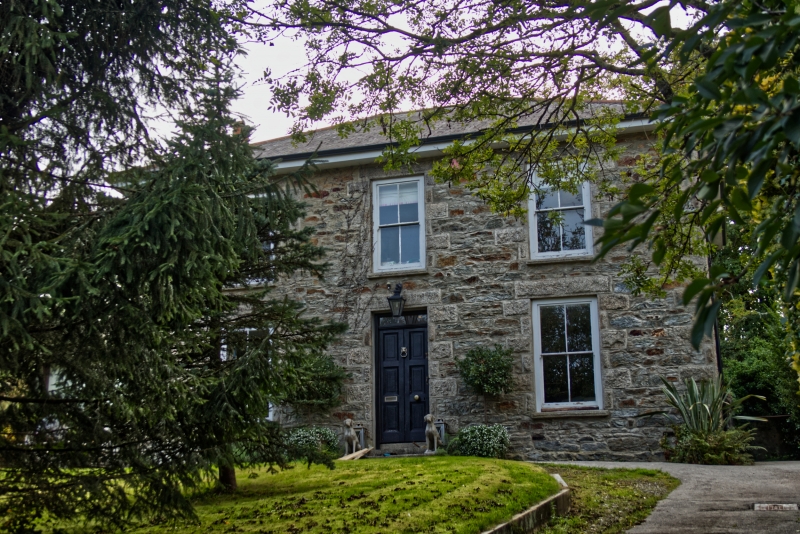
REDRUTH TOLGUS PLACE SW 64 SE 5/312 (west side) Foundry House GV II House. Mid C19; recently repaired and renovated after a period without occupation. Uncoursed killas rubble with granite quoins, slate roof. Rectangular double-depth plan. Two storeys and 3 bays, symmetrical; central doorway with shallow overlight, 2 windows at ground floor and 3 above, all 4-pane sashes, and all these openings with rock-faced quoined surrounds and lintels; hipped roof with side-wall chimneys. Interior not inspected. Associated with Sara's foundry approx. 30 metres north, and included for group value.
Listing NGR: SW6914742549
External links are from the relevant listing authority and, where applicable, Wikidata. Wikidata IDs may be related buildings as well as this specific building. If you want to add or update a link, you will need to do so by editing the Wikidata entry.


Other nearby listed buildings