Latitude: 52.2445 / 52°14'40"N
Longitude: 0.7137 / 0°42'49"E
OS Eastings: 585365
OS Northings: 264171
OS Grid: TL853641
Mapcode National: GBR QF0.780
Mapcode Global: VHKD4.BV57
Plus Code: 9F426PV7+QF
Entry Name: 49, Abbeygate Street
Listing Date: 12 July 1972
Grade: II*
Source: Historic England
Source ID: 1141138
English Heritage Legacy ID: 466605
ID on this website: 101141138
Location: Bury St Edmunds, West Suffolk, IP33
County: Suffolk
District: West Suffolk
Civil Parish: Bury St Edmunds
Built-Up Area: Bury St Edmunds
Traditional County: Suffolk
Lieutenancy Area (Ceremonial County): Suffolk
Church of England Parish: Bury St Edmunds St Mary
Church of England Diocese: St.Edmundsbury and Ipswich
Tagged with: Building
BURY ST EDMUNDS
TL8564SW ABBEYGATE STREET 639-1/14/148 (South side) 12/07/72 No.49
GV II*
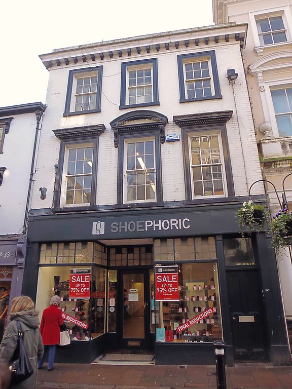
Shop with living accommodation above. Early C17 and mid C19. EXTERIOR: 3-storey painted brick front with slate roof and a 2-storey 5-bay timber-framed and rendered rear range with plaintiled roof. 3 window range to front, all small-paned sashes with stucco reveals and architraves; dentilled cornices and a segmental pediment on console brackets above the first storey windows. A C20 shop front with recessed central entry to the ground storey. A side door on the west leads into a passage running beside the long L-shaped and jettied rear range. This has a high moulded wooden cornice and had originally a continuous row of slightly projecting 6-light mullion-and-transom windows, supported on small moulded stop brackets, along the whole upper storey. Only 3 of these 6-light windows now survive, some with mullions removed; other original openings have been blocked, and there is one replacement small-paned sash window. On the ground storey, a range of similar but more heavily moulded mullion-and-transom windows are divided into 3 groups of 3 lights below a moulded fascia covering the joist-ends of the jetty. To the north of these windows are 2 small-paned sashes of c1700 with thick ovolo-moulded glazing-bars. INTERIOR: the cellar below the western half of the front has plastered rubble walls which may be medieval; arches of Tudor brick along the west wall; in the east wall, a projecting stone like a corbel is set low in the wall, with a small pointed-headed niche nearby. The rear range, in which there is no evidence for original partitions, has ovolo-moulded main beams on both storeys, trimmers with stepped stops, and covered joists. Roofs not readily accessible.
Listing NGR: TL8536564171
External links are from the relevant listing authority and, where applicable, Wikidata. Wikidata IDs may be related buildings as well as this specific building. If you want to add or update a link, you will need to do so by editing the Wikidata entry.


Other nearby listed buildings