Latitude: 54.6835 / 54°41'0"N
Longitude: -1.2948 / 1°17'41"W
OS Eastings: 445562
OS Northings: 532281
OS Grid: NZ455322
Mapcode National: GBR MGD8.GW
Mapcode Global: WHD6D.2JPW
Plus Code: 9C6WMPM4+C3
Entry Name: The Forge
Listing Date: 9 April 1973
Last Amended: 17 December 1985
Grade: II
Source: Historic England
Source ID: 1139820
English Heritage Legacy ID: 59859
ID on this website: 101139820
Location: Elwick, Hartlepool, County Durham, TS27
County: Hartlepool
Civil Parish: Elwick
Built-Up Area: Elwick
Traditional County: Durham
Lieutenancy Area (Ceremonial County): County Durham
Church of England Parish: Elwick Hall
Church of England Diocese: Durham
Tagged with: Smithy
ELWICK ELWICK VILLAGE NZ 43 SE (south side) 3/7 No. 29 (The Forge) (formerly listed as 9.4.73 Old Forge House)
-- II
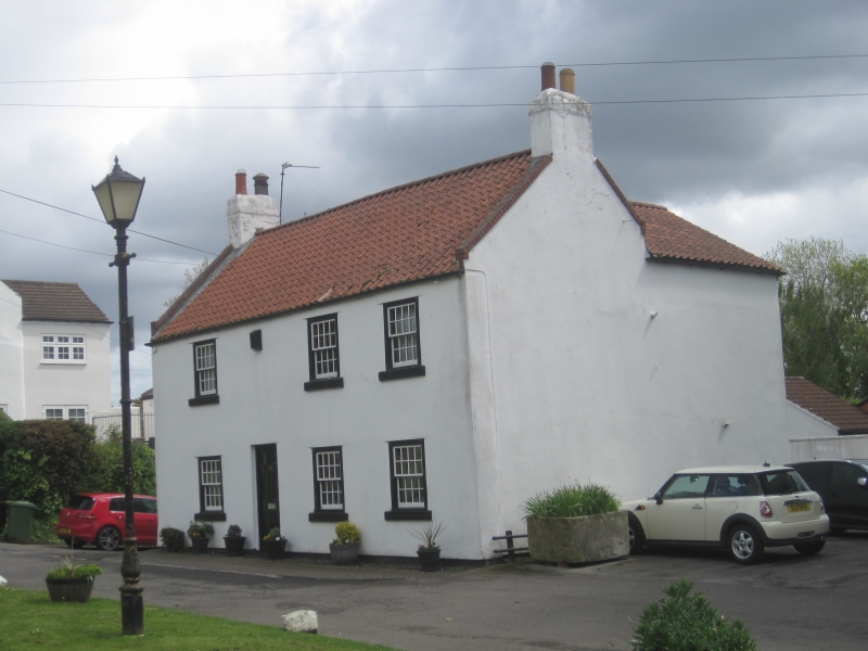
House, mid/late C18, of painted render. Late C20 clay pantile roof, rebuilt brick gable copings and end stacks. 2 storeys, 3 bays with doorway between first and 2nd bays. Sash windows with glazing bars. Contemporary 2-storey rear wing.
Listing NGR: NZ4556332282
External links are from the relevant listing authority and, where applicable, Wikidata. Wikidata IDs may be related buildings as well as this specific building. If you want to add or update a link, you will need to do so by editing the Wikidata entry.


Other nearby listed buildings