Latitude: 53.1038 / 53°6'13"N
Longitude: -2.2482 / 2°14'53"W
OS Eastings: 383476
OS Northings: 356318
OS Grid: SJ834563
Mapcode National: GBR 132.GD6
Mapcode Global: WHBCD.F7MW
Plus Code: 9C5V4Q32+GP
Entry Name: Canal Milepost
Listing Date: 26 March 1987
Grade: II
Source: Historic England
Source ID: 1138712
English Heritage Legacy ID: 56563
ID on this website: 101138712
Location: Scholar Green, Cheshire East, Cheshire, ST7
County: Cheshire East
Civil Parish: Odd Rode
Built-Up Area: Kidsgrove
Traditional County: Cheshire
Lieutenancy Area (Ceremonial County): Cheshire
Church of England Parish: Odd Rode All Saints
Church of England Diocese: Chester
Tagged with: Milestone Architectural structure
ODD RODE C.P. MACCLESFIELD CANAL SJ 85 NW 8345 5628 7/90 Canal Milepost - - II
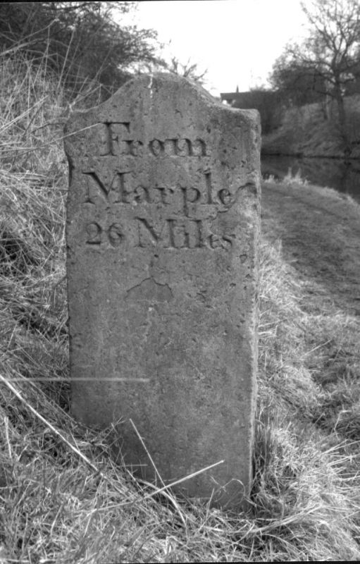
Canal milepost. circa 1827. Yellow sandstone ashlar. Rectangular stone with an arched top, one side of which is roughly hewn. The northern face reads "From/Hall Green/(obscure) Mile" and the southern face reads "From/Marple/26 Miles".
Listing NGR: SJ8347656318
External links are from the relevant listing authority and, where applicable, Wikidata. Wikidata IDs may be related buildings as well as this specific building. If you want to add or update a link, you will need to do so by editing the Wikidata entry.


Other nearby listed buildings