Latitude: 51.346 / 51°20'45"N
Longitude: -2.9777 / 2°58'39"W
OS Eastings: 332004
OS Northings: 161218
OS Grid: ST320612
Mapcode National: GBR J6.VHQ9
Mapcode Global: VH7CK.BFPJ
Plus Code: 9C3V82WC+9W
Entry Name: Emmanuel Church
Listing Date: 19 May 1983
Grade: II
Source: Historic England
Source ID: 1137779
English Heritage Legacy ID: 33221
Also known as: Emmanuel Church, Weston-super-Mare
ID on this website: 101137779
Location: Weston-super-Mare, North Somerset, BS23
County: North Somerset
Civil Parish: Weston-super-Mare
Built-Up Area: Weston-Super-Mare
Traditional County: Somerset
Lieutenancy Area (Ceremonial County): Somerset
Tagged with: Church building
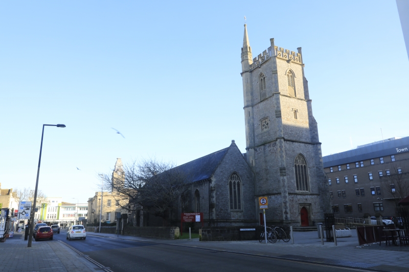
OXFORD STREET 1. 5121 Emmanuel Church ST 3261 SW 11/39 II 2. 1847 by Manners and Gill. Perpendicular. Carboniferous limestone dressings. Slate roofs. Four stage "Somerset" tower with angle buttresses. Three bay nave and north aisle. Open timber roof. Elaborate marble pulpit and screen behind altar. Interior modernized.
Listing NGR: ST3200461218
External links are from the relevant listing authority and, where applicable, Wikidata. Wikidata IDs may be related buildings as well as this specific building. If you want to add or update a link, you will need to do so by editing the Wikidata entry.


Other nearby listed buildings