Latitude: 51.5828 / 51°34'58"N
Longitude: -2.5769 / 2°34'36"W
OS Eastings: 360124
OS Northings: 187267
OS Grid: ST601872
Mapcode National: GBR JR.CGHZ
Mapcode Global: VH882.9G1Y
Plus Code: 9C3VHCMF+46
Entry Name: Post Office
Listing Date: 21 October 1952
Grade: II
Source: Historic England
Source ID: 1137069
English Heritage Legacy ID: 35320
ID on this website: 101137069
Location: Olveston, South Gloucestershire, BS35
County: South Gloucestershire
Civil Parish: Olveston
Built-Up Area: Olveston
Traditional County: Gloucestershire
Lieutenancy Area (Ceremonial County): Gloucestershire
Church of England Parish: Olveston
Church of England Diocese: Bristol
Tagged with: Post office
ST 68 NW OLVESTON THE STREET (east side)
8/215 Post Office 21.10.52 G.V. II
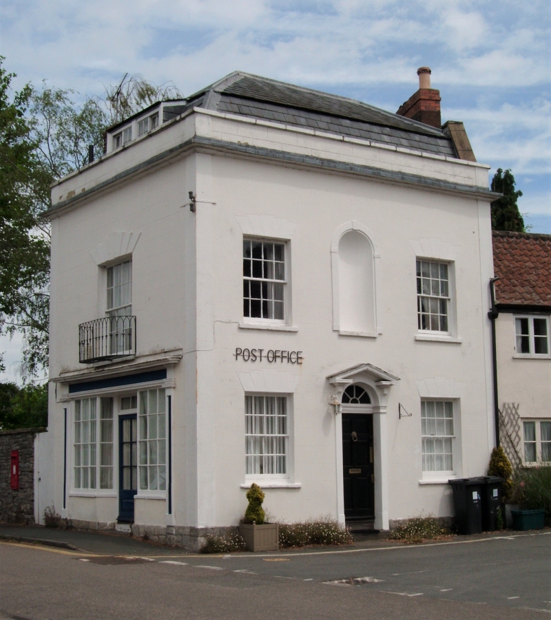
House and shop. C18 with early C19 alterations. Rubble, rendered, slate mansard roof, pantiled to north, brick stack to north. 2½ storeys, one window, west elevation has double shop front, central panelled and glass door with transom light, reeded pilasters and cornice, multi-pane window to each side, wrought iron grille in stall riser to left, 1st floor 16-pane sash with stepped voussoirs and wrought iron balconette, dormer with pair of horizontally sliding sashes of 4 panes each, corner pilasters, cornice, parapet and coping; south elevation has render scored as ashlar on rubble plinth, 2 windows, all 16-pane sashes with painted voussoirs, central round-headed recess at lst floor with impost blocks and keystone, central 6-panelled and fielded door, fanlight and radial glazing bars, pilasters, open triangular pediment on brackets. Interior: not inspected. Part of an important group at a crossroads.
Listing NGR: ST6012487267
External links are from the relevant listing authority and, where applicable, Wikidata. Wikidata IDs may be related buildings as well as this specific building. If you want to add or update a link, you will need to do so by editing the Wikidata entry.


Other nearby listed buildings