Latitude: 51.5068 / 51°30'24"N
Longitude: -0.7014 / 0°42'5"W
OS Eastings: 490221
OS Northings: 179450
OS Grid: SU902794
Mapcode National: GBR D6R.HGR
Mapcode Global: VHDWR.SDK7
Plus Code: 9C3XG74X+PC
Entry Name: The Crown Public House
Listing Date: 25 March 1955
Grade: II
Source: Historic England
Source ID: 1136213
English Heritage Legacy ID: 41059
ID on this website: 101136213
Location: Bray, Windsor and Maidenhead, Berkshire, SL6
County: Windsor and Maidenhead
Civil Parish: Bray
Built-Up Area: Maidenhead
Traditional County: Berkshire
Lieutenancy Area (Ceremonial County): Berkshire
Church of England Parish: Bray with Braywood
Church of England Diocese: Oxford
Tagged with: Pub
BRAY HIGH STREET SU 9079 (west side) 22/19 Bray 25.3.55 The Crown Public House G.V. II
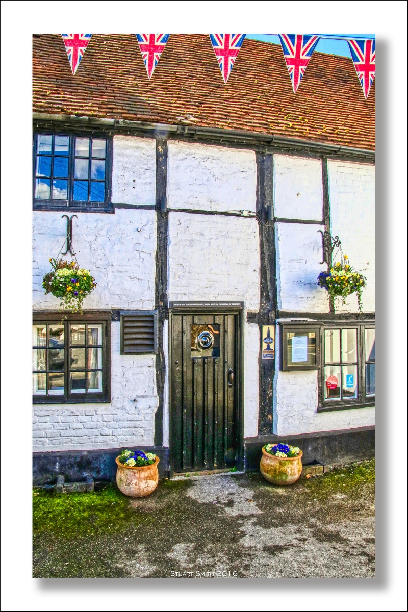
Public House. Mid C16, altered C17, C19 and C20. Part timber frame encased in painted brick, part painted brick. Old tile gabled roof. Originally rectangular plan of 2 framed bays, now U-plan with pent roof at rear. 2 storeys. 4 chimneys with offset beads and clay pots. C19 and C20 casement windows, most with glazing bars. Entrance (east) front: 2 projecting gables with irregular centre section; left gable painted brick with 2-light window on first floor and a 2- light window on each side of plain door in centre with glazed panel. Right gable with very thin framing; 2-light window on first flint and a 3-light window on ground flint to left of plain door With glazed panel. Centre section with older frame exposed; two 2-light windows on first floor. A 2-light and 3-light window on ground floor with plain C20 entrance door between. Interior: some timber frame exposed on first floor. Much false framing on ground floor.
Listing NGR: SU9022179450
External links are from the relevant listing authority and, where applicable, Wikidata. Wikidata IDs may be related buildings as well as this specific building. If you want to add or update a link, you will need to do so by editing the Wikidata entry.


Other nearby listed buildings