Latitude: 51.3853 / 51°23'7"N
Longitude: -0.9321 / 0°55'55"W
OS Eastings: 474411
OS Northings: 165681
OS Grid: SU744656
Mapcode National: GBR C6N.54W
Mapcode Global: VHDX6.SFMW
Plus Code: 9C3X93P9+45
Entry Name: Old Dunnings
Listing Date: 14 February 1986
Grade: II
Source: Historic England
Source ID: 1135946
English Heritage Legacy ID: 41615
ID on this website: 101135946
Location: Wokingham, Berkshire, RG2
County: Wokingham
Civil Parish: Swallowfield
Traditional County: Berkshire
Lieutenancy Area (Ceremonial County): Berkshire
Church of England Parish: Swallowfield
Church of England Diocese: Oxford
Tagged with: Architectural structure
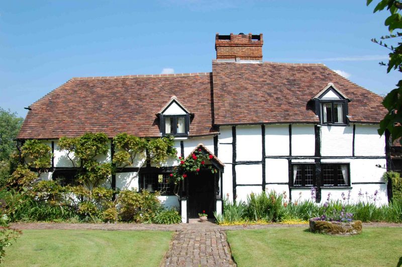
SWALLOWFIELD SWALLOWFIELD ROAD SU 76 NW (north side) Dunnings House 8/43 Old Dunnings II Cottage with byre, now one cottage. C16 and C17 altered and extended C20. Timber framed, painted brick infill; old tile half hipped roof, lower on left over former byre. L-plan of 4 framed bays, C20 extension at rear. One and a half storeys. Large chimney with offset head near centre on ridge. C20 scattered leaded casements. Entrance front:- The left hand part has 2 ground floor windows, a small gabled dormer, and door in gabled porch on the right. Right hand part has a 4-light casement with small gabled dormer over. Interior:- Timber frame exposed and an inglenook chimney.
Listing NGR: SU7441165681
External links are from the relevant listing authority and, where applicable, Wikidata. Wikidata IDs may be related buildings as well as this specific building. If you want to add or update a link, you will need to do so by editing the Wikidata entry.


Other nearby listed buildings