Latitude: 51.3724 / 51°22'20"N
Longitude: -0.9399 / 0°56'23"W
OS Eastings: 473885
OS Northings: 164238
OS Grid: SU738642
Mapcode National: GBR C6N.WQM
Mapcode Global: VHDX6.NRGS
Plus Code: 9C3X93C6+X2
Entry Name: Nutbean Farmhouse
Listing Date: 14 February 1986
Grade: II
Source: Historic England
Source ID: 1135916
English Heritage Legacy ID: 41604
ID on this website: 101135916
Location: Wokingham, Berkshire, RG7
County: Wokingham
Civil Parish: Swallowfield
Traditional County: Berkshire
Lieutenancy Area (Ceremonial County): Berkshire
Church of England Parish: Swallowfield
Church of England Diocese: Oxford
Tagged with: Farmhouse
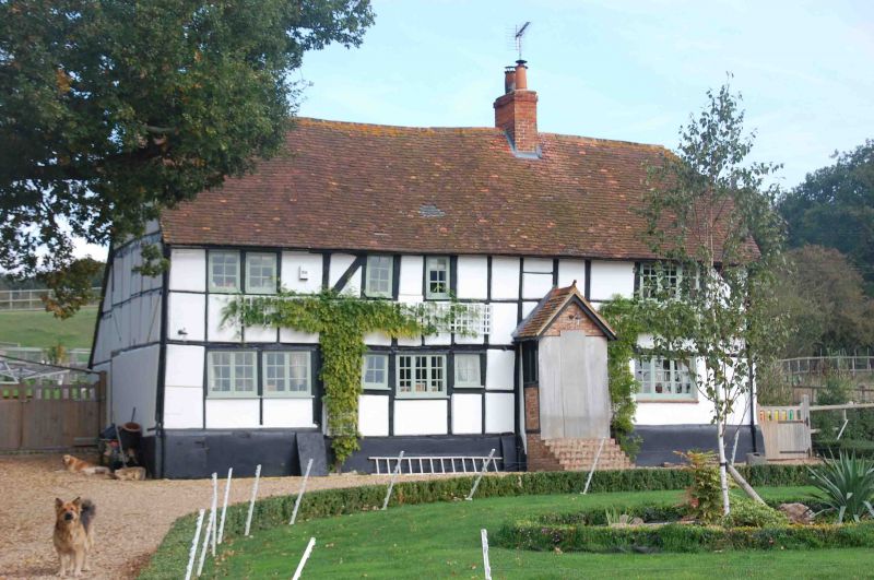
SWALLOWFIELD NUTBEAN LANE SU 76 SW (north-east side) 11/30 Nutbean Farmhouse II Farmhouse, now large cottage. Late C16 extended late C17, altered C19. Timber framed, part painted stucco infill, part painted brick; weatherboarded on right hand gable; old tile roof gabled on left hand hipped on right. Rectangular baffle entry plan, 4 framed bays with outshut at rear with one bay gabled stair turret, Rendered plinth; C19 and C20 casements with glazing bars. Entrance front:- Scattered one and 3-light casements; ledged entrance door at top of flight of brick steps to right of centre, under C20 gabled porch. Old insurance plaque at first floor level. Interior:- Most of the frame visible with heavy ceiling joists and chamfered beams. Inglenook fireplace with bread oven now covered over.
Listing NGR: SU7388664237
External links are from the relevant listing authority and, where applicable, Wikidata. Wikidata IDs may be related buildings as well as this specific building. If you want to add or update a link, you will need to do so by editing the Wikidata entry.


Other nearby listed buildings