Latitude: 53.0215 / 53°1'17"N
Longitude: -2.7658 / 2°45'56"W
OS Eastings: 348728
OS Northings: 347412
OS Grid: SJ487474
Mapcode National: GBR 7H.FLPC
Mapcode Global: WH898.H95Y
Plus Code: 9C5V26CM+JM
Entry Name: Taylor's Almshouses
Listing Date: 22 October 1952
Grade: II
Source: Historic England
Source ID: 1135874
English Heritage Legacy ID: 55566
ID on this website: 101135874
Location: Malpas, Cheshire West and Chester, Cheshire, SY14
County: Cheshire West and Chester
Civil Parish: Malpas
Built-Up Area: Malpas
Traditional County: Cheshire
Lieutenancy Area (Ceremonial County): Cheshire
Church of England Parish: Malpas St Oswald
Church of England Diocese: Chester
Tagged with: Almshouse
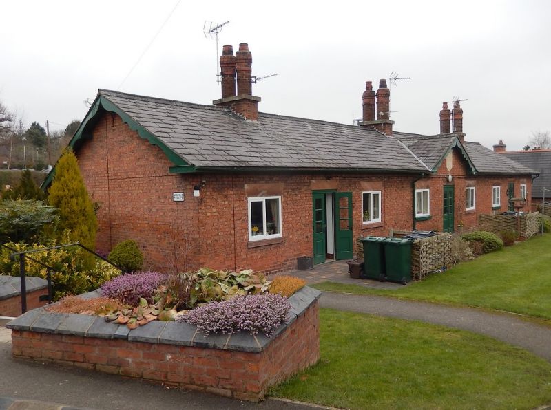
MALPAS C.P. CHESTER ROAD SJ 44 NE (South-east side) 2/23 Taylor's Almshouses 22/10/1952 GV II Row of 6 almshouses, 1854, of Flemish bond brown brickwork with graded grey slate roof. 1 storey, symmetrical, with central front gable carrying shield - shaped stone inscribed IN USUM PAUPERUM A MARIA TAYLOR MDCCCLIV. 3 recessed porches, each serving 2 almshouses. Each dwelling has 1 room at front and 1 at rear (now modified to provide bathrooms). Boarded doors. One 2-pane casement with wedge lintel and projecting cill of red sandstone to each dwelling at front. Shaped bargeboards. 3 plinthed chimneys of brick, each with 2 diagonal flues. Rear altered mid C20, in keeping. Interiors not inspected.
Listing NGR: SJ4872847412
External links are from the relevant listing authority and, where applicable, Wikidata. Wikidata IDs may be related buildings as well as this specific building. If you want to add or update a link, you will need to do so by editing the Wikidata entry.


Other nearby listed buildings