Latitude: 53.8085 / 53°48'30"N
Longitude: -1.7726 / 1°46'21"W
OS Eastings: 415070
OS Northings: 434716
OS Grid: SE150347
Mapcode National: GBR JDD.Y9
Mapcode Global: WHC98.RJ2N
Plus Code: 9C5WR65G+CX
Entry Name: Manningham Old Manor House
Listing Date: 9 August 1983
Grade: II
Source: Historic England
Source ID: 1132909
English Heritage Legacy ID: 337062
ID on this website: 101132909
Location: Manningham, Bradford, West Yorkshire, BD8
County: Bradford
Electoral Ward/Division: Manningham
Parish: Non Civil Parish
Built-Up Area: Bradford
Traditional County: Yorkshire
Lieutenancy Area (Ceremonial County): West Yorkshire
Church of England Parish: Manningham St Paul and St Jude
Church of England Diocese: Leeds
Tagged with: House
1. 5111 ROSEBERY ROAD Manningham BD8
Nos 23 and 23A (Manningham Old Manor House) SE 1534 NW 28/92
II
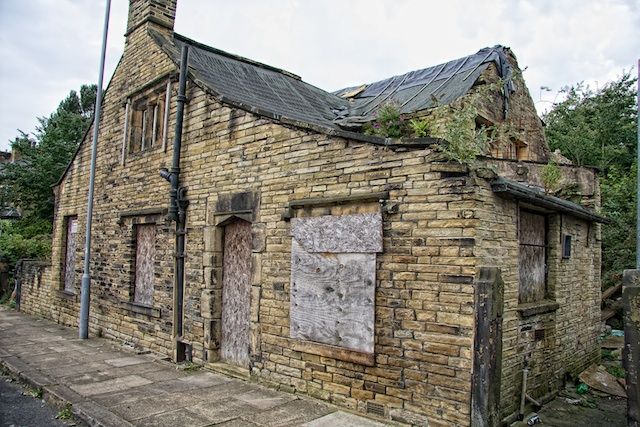
2. Mid C17 manor house of which only part of the hall range (of l½ storeys) and the north cross wing remain. Coursed gritstone, the front apparently refaced late C18 with even sandstone "bricks", flush quoins. Saddlestones to gable ends, long shaped kneelers to cross wing and shaped finials. Gabled stone dormer with finial to hall. Three light large chamfered mullion window with drip mould to hall. Two light chamfered mullion windows with drip moulds to wing. The rear gable of wing has 2 large mullion and transom-windows, one with heraldic stained glass. Interior entirely refurbished circa 1900, beams plastered over.
Listing NGR: SE1507034716
External links are from the relevant listing authority and, where applicable, Wikidata. Wikidata IDs may be related buildings as well as this specific building. If you want to add or update a link, you will need to do so by editing the Wikidata entry.


Other nearby listed buildings