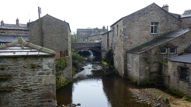
Latitude: 54.3037 / 54°18'13"N
Longitude: -2.1952 / 2°11'42"W
OS Eastings: 387396
OS Northings: 489803
OS Grid: SD873898
Mapcode National: GBR FL3P.K0
Mapcode Global: WHB5M.73X1
Plus Code: 9C6V8R33+FW
Entry Name: Hawes Bridge
Listing Date: 9 July 1986
Grade: II
Source: Historic England
Source ID: 1132029
English Heritage Legacy ID: 323119
ID on this website: 101132029
Location: Hawes, North Yorkshire, DL8
County: North Yorkshire
District: Richmondshire
Civil Parish: Hawes
Built-Up Area: Hawes
Traditional County: Yorkshire
Lieutenancy Area (Ceremonial County): North Yorkshire
Tagged with: Bridge
HAWES A684 NORTH YORKSHIRE RICHMONDSHIRE 5339 SD 88 NE Hawes 20/96 Bridge - II Bridge. C18. Rubble. Single segmental arch of rubble voussoirs with hood- mould. Segmental coping to parapet. Rectangular opening in west abutment which carried pentrough from waterfall upstream of bridge to former corn watermill approximately 30 metres downstream.
Listing NGR: SD8739689803
External links are from the relevant listing authority and, where applicable, Wikidata. Wikidata IDs may be related buildings as well as this specific building. If you want to add or update a link, you will need to do so by editing the Wikidata entry.


Other nearby listed buildings