Latitude: 54.1181 / 54°7'5"N
Longitude: -2.5115 / 2°30'41"W
OS Eastings: 366663
OS Northings: 469256
OS Grid: SD666692
Mapcode National: GBR BNXT.2J
Mapcode Global: WH953.DR9C
Plus Code: 9C6V4F9Q+6C
Entry Name: 33 and 35 Main Street
Listing Date: 24 June 1988
Grade: II
Source: Historic England
Source ID: 1131626
English Heritage Legacy ID: 324085
ID on this website: 101131626
Location: High Bentham, North Yorkshire, LA2
County: North Yorkshire
District: Craven
Civil Parish: Bentham
Built-Up Area: High Bentham
Traditional County: Yorkshire
Lieutenancy Area (Ceremonial County): North Yorkshire
Church of England Parish: Bentham
Church of England Diocese: Leeds
Tagged with: Architectural structure
This list entry was subject to a Minor Amendment on 12 November 2024 to update the name and address and reformat the text to current standards
SD 66 NESD 66 NE
6/24
BENTHAM
High Bentham
MAIN STREET (south side)
No 33 and 35
(Formerly listed as Ward's Grocers and Pigtails)
II
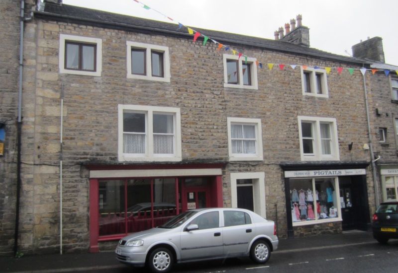
Formerly house, now two shops. Early C19. Watershot masonry, stone dressings, tile roof. Three storeys, three bays. Central entrance has plain surround; six-panel door and rectangular fanlight. Flanked by two late C19 shopfronts each with right-hand entrance and four panel door. First floor has three two-light flat-faced mullioned windows with mullion of smaller central window now gone. Three two-light flat-faced mullioned windows on second floor; sashes. To left is late C19 loft entrance with plain surround; plank door. Gable end ridge stacks.
Listing NGR: SD6666369256
External links are from the relevant listing authority and, where applicable, Wikidata. Wikidata IDs may be related buildings as well as this specific building. If you want to add or update a link, you will need to do so by editing the Wikidata entry.


Other nearby listed buildings