Latitude: 54.3941 / 54°23'38"N
Longitude: -1.6755 / 1°40'31"W
OS Eastings: 421165
OS Northings: 499894
OS Grid: SE211998
Mapcode National: GBR JKRM.1M
Mapcode Global: WHC6F.7TD9
Plus Code: 9C6W98VF+JQ
Entry Name: Brompton Bridge
Listing Date: 6 November 1986
Grade: II
Source: Historic England
Source ID: 1131590
English Heritage Legacy ID: 322067
ID on this website: 101131590
Location: Brompton-on-Swale, North Yorkshire, DL10
County: North Yorkshire
District: Richmondshire
Civil Parish: Brompton-on-Swale
Traditional County: Yorkshire
Lieutenancy Area (Ceremonial County): North Yorkshire
Church of England Parish: Easby with Brompton on Swale and Bolton on Swale
Church of England Diocese: Leeds
Tagged with: Bridge Road bridge
BROMPTON-ON-SWALE B 6271 SE 2099-2199 11/4 Brompton Bridge
- II
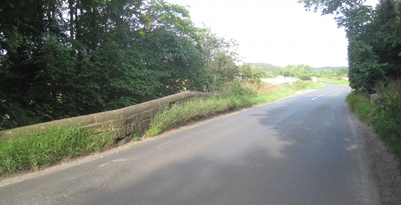
Bridge. Possibly in part of 1691, with mid - late C18 and early C19 rebuilding and widening. Ashlar and rubble. Single segmental arch. Downstream side, older section: rubble with ashlar voussoirs and slab hood- mould; cobble parapet with segmental ashlar coping. Widened upstream: ashlar sandstone with rock-faced rusticated voussoirs; band; ashlar parapet with segmental coping. An older bridge, in existence in the C12, was rebuilt in 1691, and possibly again, and widened later. The road from Brompton to Richmond was turnpiked 1750-1. Brompton-on-Swale Workers' Education Association, Guided Walk Round Old Brompton-on-Swale (1983), item 41; Clarkson, History of Richmond, (1821), p 389ff; Jervoise, Ancient Bridges of the North of England (1931), p 87; VCH i, p 51.
Listing NGR: SE2116599894
External links are from the relevant listing authority and, where applicable, Wikidata. Wikidata IDs may be related buildings as well as this specific building. If you want to add or update a link, you will need to do so by editing the Wikidata entry.


Other nearby listed buildings