Latitude: 54.2632 / 54°15'47"N
Longitude: -1.8851 / 1°53'6"W
OS Eastings: 407583
OS Northings: 485286
OS Grid: SE075852
Mapcode National: GBR HM84.PJ
Mapcode Global: WHC73.03ML
Plus Code: 9C6W7477+7X
Entry Name: Hall Garth Farmhouse with Attached Outbuilding
Listing Date: 13 February 1967
Last Amended: 6 April 1988
Grade: II
Source: Historic England
Source ID: 1131374
English Heritage Legacy ID: 322582
ID on this website: 101131374
Location: Melmerby, North Yorkshire, DL8
County: North Yorkshire
District: Richmondshire
Civil Parish: Melmerby
Traditional County: Yorkshire
Lieutenancy Area (Ceremonial County): North Yorkshire
Tagged with: Farmhouse
MELMERBY MELMERBY SE 08 NE 3/100 Hall Garth Farmhouse with attached outbuilding 13.2.67 (formerly listed as Hall Garth) - II
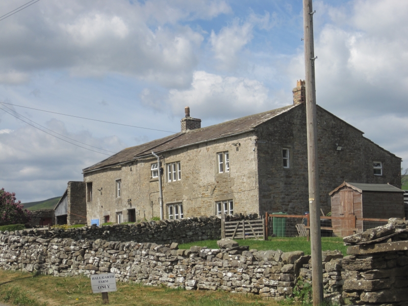
Farmhouse and outbuilding under 1 roof. Late C17 - early C18. Coursed rubble, part roughcast, stone slate roof. 2 storeys with rear outshut, 1:1:3 first-floor openings. Main house to right, ground floor from left: C20 part-glazed door in ashlar chamfered quoined surround; two 3-light double-chamfered mullion windows. First floor, from left: C20 4-pane casement window; 3-light double-chamfered mullion window, 2-light double- chamfered mullion window. Left 2 bays slightly recessed: central board door in ashlar chamfered surround; to its left, 1 bay of 2-light double-chamfered mullion windows. On first floor to left, hayloft opening. Ashlar coping at ends and to right of main door. Brick stacks above central and right copings. Interior: in kitchen, to left of main door, an inglenook with chamfered curved beam, stop-chamfered beams.
Listing NGR: SE0758385286
External links are from the relevant listing authority and, where applicable, Wikidata. Wikidata IDs may be related buildings as well as this specific building. If you want to add or update a link, you will need to do so by editing the Wikidata entry.


Other nearby listed buildings