Latitude: 54.454 / 54°27'14"N
Longitude: -1.786 / 1°47'9"W
OS Eastings: 413975
OS Northings: 506532
OS Grid: NZ139065
Mapcode National: GBR HJZY.44
Mapcode Global: WHC65.J9RV
Plus Code: 9C6WF637+HJ
Entry Name: Dakyn House
Listing Date: 4 February 1969
Last Amended: 4 December 1987
Grade: II
Source: Historic England
Source ID: 1131325
English Heritage Legacy ID: 322762
ID on this website: 101131325
Location: Kirby Hill, North Yorkshire, DL11
County: North Yorkshire
District: Richmondshire
Civil Parish: Kirby Hill
Traditional County: Yorkshire
Lieutenancy Area (Ceremonial County): North Yorkshire
Church of England Parish: Kirkby Ravensworth
Church of England Diocese: Leeds
Tagged with: House
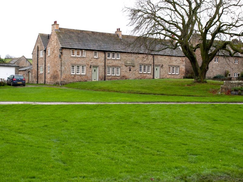
NZ 1306 KIRBY HILL VILLAGE GREEN (south side) 17/61 Dakyn House (formerly listed as John Dakin's Almshouse)
4.2.69
GV II
Hospital of St John the Baptist, now almshouses. Dated 1754. Founded by Rev John Dakyn, DD. Coursed rubble, stone slate roofs. Double-depth plan. 2 and 1 storeys, 4 bays to the Green. Quoins at ends and left of second bay. All openings have C20 ashlar architraves, the windows mostly 3-light mullion. From left: a window on each floor; board door with single-light window above; a window on each floor; C20 plaque with present name, and above it a circular plaque inscribed "Built by Tho. Buckton, Fra. Allen 1754"; ground-floor window; board door; ground-floor window. Rebuilt stacks at ends and centre. 2-span roof. The hospital was founded by Rev John Dakyn, DD, at the same time as the Grammar School (qv). The hospital originally accommodated 27 inmates, reduced to 12 men and 12 women in 1803 when the building was extended, and was converted into a smaller number of flats in the 1950s. T Bulmer, History, Topography and Directory of North Yorkshire, (1890), pp 466-467; VCH i, p 97; W White, History, Gazetteer and Directory of the East and North Ridings of Yorkshire, (1840), pp 651-652.
Listing NGR: NZ1398106534
External links are from the relevant listing authority and, where applicable, Wikidata. Wikidata IDs may be related buildings as well as this specific building. If you want to add or update a link, you will need to do so by editing the Wikidata entry.


Other nearby listed buildings