Latitude: 51.1745 / 51°10'28"N
Longitude: -1.781 / 1°46'51"W
OS Eastings: 415402
OS Northings: 141723
OS Grid: SU154417
Mapcode National: GBR 503.6K0
Mapcode Global: VHB5C.2QSZ
Plus Code: 9C3W56F9+RH
Entry Name: Kent House
Listing Date: 10 January 1953
Grade: II*
Source: Historic England
Source ID: 1131093
English Heritage Legacy ID: 321338
ID on this website: 101131093
Location: Amesbury, Wiltshire, SP4
County: Wiltshire
Civil Parish: Amesbury
Built-Up Area: Amesbury
Traditional County: Wiltshire
Lieutenancy Area (Ceremonial County): Wiltshire
Church of England Parish: Amesbury St Mary and St Melor
Church of England Diocese: Salisbury
Tagged with: House
AMESBURY COUNTESS ROAD SU 1541 (west side)
11/27 No 3 (Kent House) 10.1.53
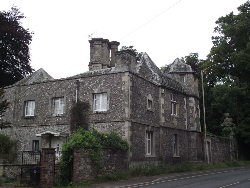
GV II* Lodge to Amesbury Abbey and farmhouse for Park Farm, now house. 1607 and c1733. Flint with stone dressings, fissile stone slate roofs. Irregular triangular block with an octagonal stair turret on north-east side, and added on south, an C18 rectangular block in knapped flintwork and stone. Original building has C18 stone surround to ground floor window and a chamfered mullioned and transomed cross window to upper floor. Moulded string courses and lozenge panel. Moulded stone cornice and ogee roof. Stair tower is of 3 storeys defined by string courses. Recessed reserved stone surrounds to square windows. Stone cornice and ogee roof. Lozenge on north-east face with date 1607. Added on south, a rectangular block of 3 bays, ground floor raised, and stone plat band. Architraves to windows and stepped flush keystones. Central 6- panelled door with dentilled pediment on carved brackets. Block extended to west at slight angle, with parapet. To rear, a single storey block in matching squared knapped flintwork added c1960.
Listing NGR: SU1540241723
External links are from the relevant listing authority and, where applicable, Wikidata. Wikidata IDs may be related buildings as well as this specific building. If you want to add or update a link, you will need to do so by editing the Wikidata entry.


Other nearby listed buildings