Latitude: 51.172 / 51°10'19"N
Longitude: -1.7822 / 1°46'55"W
OS Eastings: 415325
OS Northings: 141443
OS Grid: SU153414
Mapcode National: GBR 503.D81
Mapcode Global: VHB5C.2S6W
Plus Code: 9C3W56C9+R4
Entry Name: The Kings Arms
Listing Date: 10 January 1953
Grade: II
Source: Historic England
Source ID: 1131092
English Heritage Legacy ID: 321336
ID on this website: 101131092
Location: Amesbury, Wiltshire, SP4
County: Wiltshire
Civil Parish: Amesbury
Built-Up Area: Amesbury
Traditional County: Wiltshire
Lieutenancy Area (Ceremonial County): Wiltshire
Church of England Parish: Amesbury St Mary and St Melor
Church of England Diocese: Salisbury
Tagged with: Pub
AMESBURY CHURCH STREET SU 1541 (south side)
11/24 The Kings Arms 10.1.53
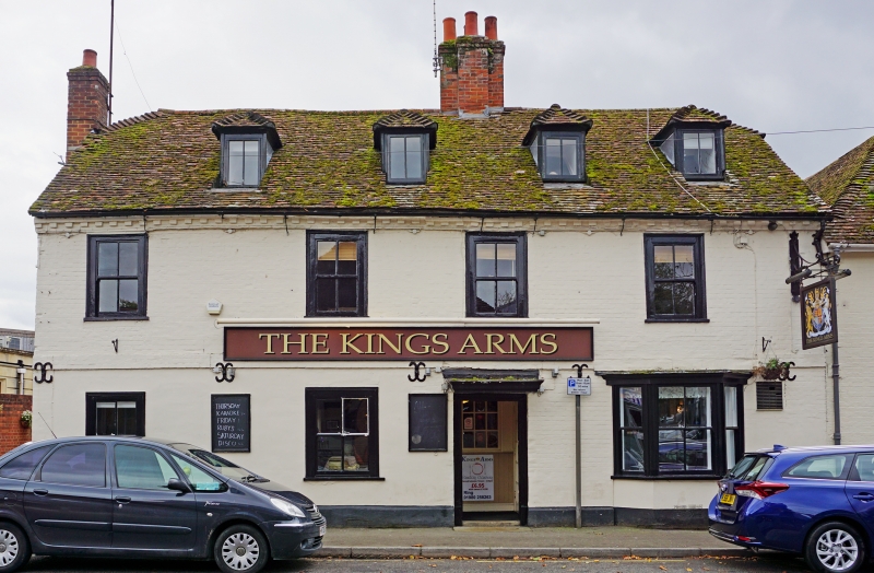
GV II Inn. Mid C18. Painted brick with tiled roof. Two storeys and attic, 4 bays. Plat band and brick dentilled eaves. Entrance in third bay in half-glazed door with moulded flat canopy. Early C19 four-paned sash windows with wide boxes and a canted Cl9 bay window on right bay. Four hipped dormers without glazing bars. Four flue stack opposite door, and secondary stack added to left gable end. Various additions to rear. Roof half hipped. Interior has large open fireplace with timber lintel and fireplace with bolection moulded surround. Five bay butt purlin roof.
Listing NGR: SU1532541442
External links are from the relevant listing authority and, where applicable, Wikidata. Wikidata IDs may be related buildings as well as this specific building. If you want to add or update a link, you will need to do so by editing the Wikidata entry.


Other nearby listed buildings