Latitude: 54.4015 / 54°24'5"N
Longitude: -1.7762 / 1°46'34"W
OS Eastings: 414626
OS Northings: 500689
OS Grid: NZ146006
Mapcode National: GBR JK1J.8Z
Mapcode Global: WHC6C.PMDM
Plus Code: 9C6WC62F+HG
Entry Name: Lownethwaite Bridge
Listing Date: 26 March 1986
Grade: II
Source: Historic England
Source ID: 1130829
English Heritage Legacy ID: 321918
ID on this website: 101130829
Location: Hudswell, North Yorkshire, DL10
County: North Yorkshire
District: Richmondshire
Civil Parish: Richmond
Traditional County: Yorkshire
Lieutenancy Area (Ceremonial County): North Yorkshire
Church of England Parish: Richmond with Holy Trinity with Hudswell
Church of England Diocese: Leeds
Tagged with: Bridge
NORTH YORKSHIRE RICHMONDSHIRE 5339 NZ 10 SW HUDSWELL A6108
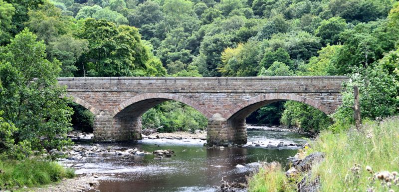
1/33 Lownethwaite Bridge II Bridge. 1836. Rock-faced stone. Five segmental arches (2 dry) on pointed cutwaters. Ashlar band. Coursed rubble parapet with segmental coping. Weathered inscription panel on inner face of downstream parapet. Constructed for the Richmond-Reeth turnpike road. Half the bridge is in the parish of Richmond.
Listing NGR: NZ1462900693
External links are from the relevant listing authority and, where applicable, Wikidata. Wikidata IDs may be related buildings as well as this specific building. If you want to add or update a link, you will need to do so by editing the Wikidata entry.


Other nearby listed buildings