Latitude: 51.0892 / 51°5'20"N
Longitude: -2.2705 / 2°16'13"W
OS Eastings: 381150
OS Northings: 132240
OS Grid: ST811322
Mapcode National: GBR 0V3.NSH
Mapcode Global: FRA 6647.M8D
Plus Code: 9C3V3PQH+MQ
Entry Name: Dean's Orchard
Listing Date: 6 January 1966
Last Amended: 7 July 1989
Grade: II
Source: Historic England
Source ID: 1130723
English Heritage Legacy ID: 320176
ID on this website: 101130723
Location: Mere, Wiltshire, BA12
County: Wiltshire
Civil Parish: Mere
Built-Up Area: Mere
Traditional County: Wiltshire
Lieutenancy Area (Ceremonial County): Wiltshire
Church of England Parish: Mere St Michael the Archangel
Church of England Diocese: Salisbury
Tagged with: Architectural structure
ST 8032-8132 MERE CHURCH STREET (off south side)
6/49 Dean's Orchard (formerly listed as: The Vicarage, 6.1.66 formerly Dean's Orchard)
GV II
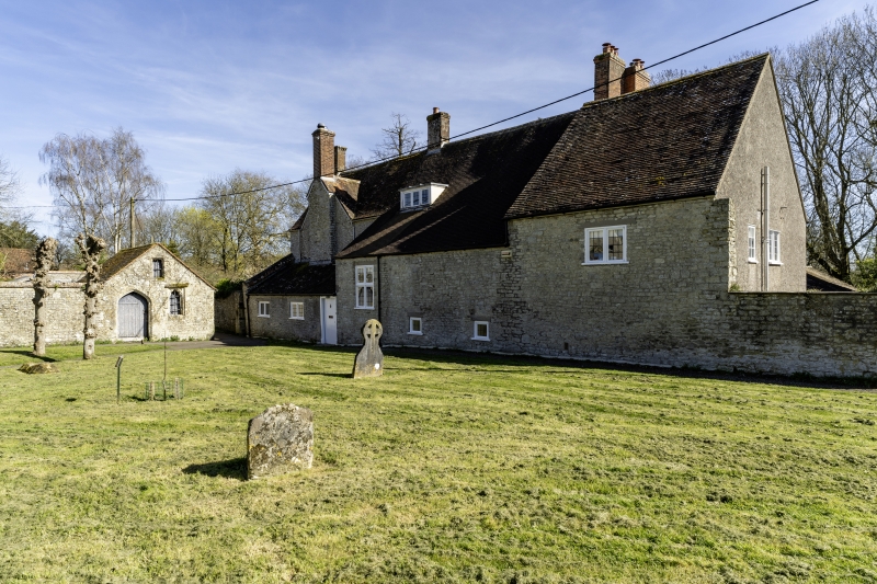
Large detached house, adjoining churchyard. 1708 and 1756, extended across north side later. Good squared and coursed Doulting stone to front (south) with some Chilmark stone including quoins, mainly rubble elsewhere, plain tile roof. Originally a 3-bay symmetrical C18 house on 3 floors plus attics, in mid C18 extended by further 3-bays on 2 floors and attics, under continuous roof line, with especially lofty ground floor in later half; to left is lower, 2-storey unit. Garden front has at ground floor three 2-light horizontal glazing bar casements to keyed voussoirs, then part-glazed door under 3-pane transom light plus two large 12-pane sashes to voussoirs and keystone. At eaves are two 2-light casements and a painted blocked opening then three 12-pane sashes; at intermediate level in left half one casement and one 12-pane sash, both to keyed voussoirs Four large hipped dormers; to left with blocked painted-on windows, a 2-light casement and a 12-pane light. To left is 2-storey 1-window service unit; this section rendered. Rear, towards churchyard, in coursed rubble has scattered fenestration, with, at ground floor, two 2-light casements and 2-small square lights, also a 2-light with transom, to stair, with 3-light flat-roofed dormer above. Far right, in lower unit, a 2-light at eaves, most openings with concrete lintels. Left is plank door in plain frame. A large external stack with shaft in brick to gable, left, and 3 ridge stacks. The external wall of the C18 building is mainly concealed by later swept-down or lean-to additions on the side. Interior: cross passage from south leads to fielded 6-panel door, probably a principal entry before addition of later corridor and lean-to. Many fielded panel painted doors, shutters to high room to right which also has chair rail and decorative cornice; two rooms to left with lower ceilings, and with small rough chamfered beams. The far room has two recessed to cambered arches in soft red brick dressings, perhaps originally external openings. At first floor the date 1756 is scratched in plaster. Between early and later sections a 2-light opening, with lath and plaster. Roof to 1708 section is pegged 2-purlin double collar; the intermediate gable wall retains a 2-light window, now internal. A further 2-light window at first floor is also now internal. The name of the property derives from a grant by Edmund, son of the Earl of Cornwall, in 1280, to the Dean and Chapter of Salisbury, of land here including a mill for grinding corn. It remained with the Ecclesiastical Commissioners until 1969. (Mere: A Wiltshire Country Town; 1975).
Listing NGR: ST8114432237
External links are from the relevant listing authority and, where applicable, Wikidata. Wikidata IDs may be related buildings as well as this specific building. If you want to add or update a link, you will need to do so by editing the Wikidata entry.


Other nearby listed buildings