Latitude: 53.1989 / 53°11'56"N
Longitude: -2.7616 / 2°45'41"W
OS Eastings: 349216
OS Northings: 367139
OS Grid: SJ492671
Mapcode National: GBR 7H.2FPB
Mapcode Global: WH889.KV4J
Plus Code: 9C5V56XQ+H8
Entry Name: Number 86 and Attached Outbuilding
Listing Date: 12 January 1973
Grade: II
Source: Historic England
Source ID: 1130541
English Heritage Legacy ID: 55769
ID on this website: 101130541
Location: Tarvin, Cheshire West and Chester, Cheshire, CH3
County: Cheshire West and Chester
Civil Parish: Tarvin
Built-Up Area: Tarvin
Traditional County: Cheshire
Lieutenancy Area (Ceremonial County): Cheshire
Church of England Parish: Tarvin St Andrew
Church of England Diocese: Chester
Tagged with: Building
SJ 46 NE TARVIN C.P. HIGH STREET (South Side)
2/65 No. 86 and attached outbuilding. 12/1/1973
GV II
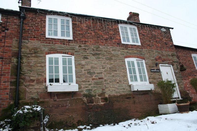
Formerly pair of cottages and shippon, now house and store: late C17/early C18 with early C19 raising of roof and openings. Buff sandstone rubble with some heavy quoins on ground storey, irregular orange brickwork to upper storey, on natural rock outcrop. Welsh slate roof. 2 gable brick chimneys. 2-storey, 3-bay front to house. 2-light wooden casements with rectangular leaded lights, under shallow segmental brick heads. Board door at right end approached by 2 steps. Outbuilding to left is lower, partly of stone blocks, mainly orange brick. Blocked doorway now contains a small window. 2 diamond ventilation patterns above. Interior: not inspected.
Listing NGR: SJ4921667139
External links are from the relevant listing authority and, where applicable, Wikidata. Wikidata IDs may be related buildings as well as this specific building. If you want to add or update a link, you will need to do so by editing the Wikidata entry.


Other nearby listed buildings