Latitude: 51.6076 / 51°36'27"N
Longitude: -2.5263 / 2°31'34"W
OS Eastings: 363647
OS Northings: 189998
OS Grid: ST636899
Mapcode National: GBR JT.9WS4
Mapcode Global: VH87X.5V9G
Plus Code: 9C3VJF5F+3F
Entry Name: 24 High Street
Listing Date: 21 September 1952
Last Amended: 17 December 1984
Grade: II
Source: Historic England
Source ID: 1128806
English Heritage Legacy ID: 34964
ID on this website: 101128806
Location: Thornbury, South Gloucestershire, BS35
County: South Gloucestershire
Civil Parish: Thornbury
Built-Up Area: Thornbury
Traditional County: Gloucestershire
Lieutenancy Area (Ceremonial County): Gloucestershire
Church of England Parish: Thornbury St Mary
Church of England Diocese: Gloucester
Tagged with: Building
This list entry was subject to a Minor Amendment on 17 June 2025 to amend the name and address and to reformat the text to current standards
ST 6390
ST 6389
4/60
5/60
THORNBURY
HIGH STREET (west side)
No 24
(formerly listed as No 24 (Heritage), previously listed as premises opposite Soapers Lane)
21.9.52.
GV
II
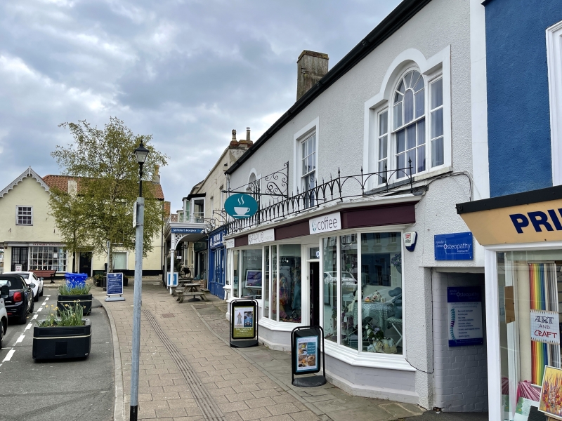
Mid-late C18 remodelling of C16 building. Render, lined out as ashlar. Double Roman tiled roof. Iron gutter with repousse animal heads. Three windows, glazing bar sashes, outer ones are Venetian windows. Later shopfronts and doors on ground floor, all under a continuous roof with a cast iron Gothic balustrade.
Interior: wind-braced roof. Stop-chamfered beams. Blocked four-centred door to former side passage on south wall.
Listing NGR: ST6364789998
External links are from the relevant listing authority and, where applicable, Wikidata. Wikidata IDs may be related buildings as well as this specific building. If you want to add or update a link, you will need to do so by editing the Wikidata entry.


Other nearby listed buildings