Latitude: 51.61 / 51°36'35"N
Longitude: -2.5262 / 2°31'34"W
OS Eastings: 363657
OS Northings: 190258
OS Grid: ST636902
Mapcode National: GBR JT.9WSL
Mapcode Global: VH87X.5SBN
Plus Code: 9C3VJF5F+XG
Entry Name: Wigmore House
Listing Date: 21 September 1952
Last Amended: 17 December 1984
Grade: II
Source: Historic England
Source ID: 1128782
English Heritage Legacy ID: 34907
ID on this website: 101128782
Location: Thornbury, South Gloucestershire, BS35
County: South Gloucestershire
Civil Parish: Thornbury
Built-Up Area: Thornbury
Traditional County: Gloucestershire
Lieutenancy Area (Ceremonial County): Gloucestershire
Church of England Parish: Thornbury St Mary
Church of England Diocese: Gloucester
Tagged with: House
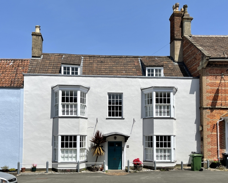
THORNBURY CASTLE STREET 4/8 (east side) ST 6390 21.9.52 No 10 (Wigmore House) GV (formerly listed as Wigmore House) II
Late C17, possibly remodelling of earlier building; altered and extended in C18. Rendered. Double Roman tiled roof. 2 storeys and attic. 3 windows: 12 and 16 pane modern glazing bar sashes, other two are 2-storey bays; 2-light casements for dormers. Central 6 panel door under segmental hood on scroll brackets. Interior: rear wing is late C17 parlour. Moulded beams. Fine decorative plaster ceiling on ground floor and incised plaster decoration to ceiling of first floor landing. Open well stair with twisted balusters, moulded handrail. Spice cupboards with scratch moulded doors on ground and first floor. External door at foot of stairs has scroll and ovolo moulded frame with elaborate converging stops. Sources: L Hall (1982). Report in NMR.
Listing NGR: ST6365790258
External links are from the relevant listing authority and, where applicable, Wikidata. Wikidata IDs may be related buildings as well as this specific building. If you want to add or update a link, you will need to do so by editing the Wikidata entry.


Other nearby listed buildings