Latitude: 52.4015 / 52°24'5"N
Longitude: -0.0872 / 0°5'13"W
OS Eastings: 530230
OS Northings: 279891
OS Grid: TL302798
Mapcode National: GBR K3C.GR5
Mapcode Global: VHGLK.FWRV
Plus Code: 9C4XCW27+J4
Entry Name: 28, Church Road
Listing Date: 24 October 1951
Last Amended: 4 November 1982
Grade: II*
Source: Historic England
Source ID: 1128357
English Heritage Legacy ID: 54195
ID on this website: 101128357
Location: Ramsey End, Huntingdonshire, Cambridgeshire, PE28
County: Cambridgeshire
District: Huntingdonshire
Civil Parish: Warboys
Built-Up Area: Warboys
Traditional County: Huntingdonshire
Lieutenancy Area (Ceremonial County): Cambridgeshire
Church of England Parish: Warboys St Mary Magdalene
Church of England Diocese: Ely
Tagged with: Building
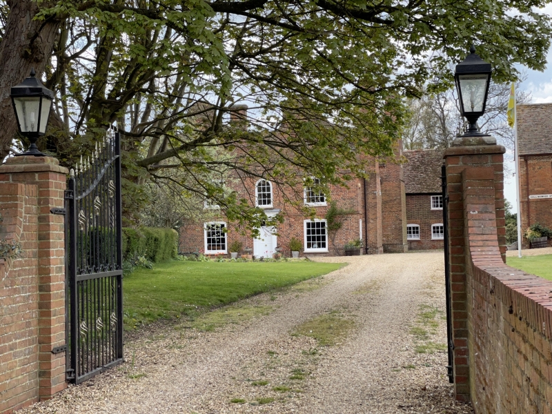
WARBOYS CHURCH ROAD 1. 5140 (west side) No 28 (formerly listed as Manor House) TL 37 NW 4/5 24.10.51 II* GV 2. Early C17 house. L-plan. Narrow red brick. Plain tiled roof of two parallel linked ranges with shaped gable ends. Saw-tooth eaves cornice to sides. Two projecting chimney stacks to north. One with two and the other with three diagonally set detached shafts. Band course above first-floor and between first and ground-floors. Two later hung sashes with glazing bars in moulded architraves at first-floor. Two similar windows at ground floor. Central doorway. Early C19 doorcase of pilasters with simplified Doric frieze and shaped cornice. Panelled door. Rectangular fanlight with glazing bars. Original semi-circular headed staircase window in north wall. Leaded lights and moulded mullion. Sundial to south wall. Interior has early C17 staircase of three flights and landing. Closed-string with turned balusters, moulded rail, square section newel posts with carved finials. Adjoining C17 kitchen to north-east. Red brick. Plain tiled with dentil cornice. Two-storeys. C17 red brick curtilage wall to south-east with saw-tooth brackets to coping. (RCHM Huntingdonshire p 284).
Listing NGR: TL3023079891
External links are from the relevant listing authority and, where applicable, Wikidata. Wikidata IDs may be related buildings as well as this specific building. If you want to add or update a link, you will need to do so by editing the Wikidata entry.


Other nearby listed buildings