Latitude: 52.3994 / 52°23'57"N
Longitude: 0.2634 / 0°15'48"E
OS Eastings: 554086
OS Northings: 280339
OS Grid: TL540803
Mapcode National: GBR M6H.FDZ
Mapcode Global: VHHJ6.JY3J
Plus Code: 9F4297X7+Q9
Entry Name: 12-14, High Street
Listing Date: 23 September 1950
Grade: II
Source: Historic England
Source ID: 1126484
English Heritage Legacy ID: 48741
ID on this website: 101126484
Location: Ely, East Cambridgeshire, CB7
County: Cambridgeshire
District: East Cambridgeshire
Civil Parish: Ely
Built-Up Area: Ely
Traditional County: Cambridgeshire
Lieutenancy Area (Ceremonial County): Cambridgeshire
Church of England Parish: Ely
Church of England Diocese: Ely
Tagged with: Bank building
This list entry was subject to a Minor Amendment on 16 April 2025 to update the Name and Address and reformat the text to current standards
TL 5480
1/76
HIGH STREET (South Side)
Nos 12-14
(Formerly listed as Nos 12 & 14 (Trustee Savings Bank))
23.9.50.
GV
II
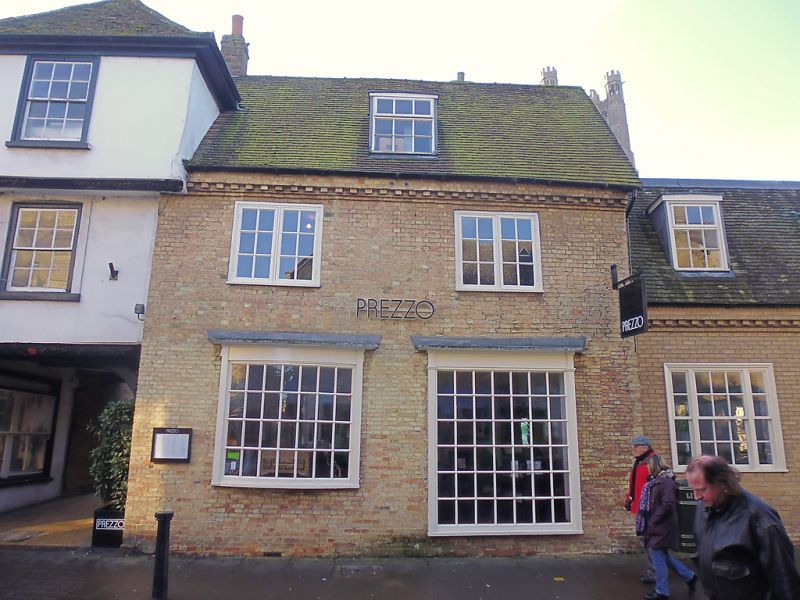
A C18 buff coloured brick house incorporating an earlier structure. Two storeys and attics. Two window range, casements on the first storey and C18 shop windows with glazing bars on the ground storey, one is a flat bow. Roof tiled, with brick dentil caves course and one flat headed dormer.
All the listed buildings in High Street except No 2 form a group with The Almonry, Wall to the gardens of the Almonry and Painted Chamber, The Sacristy Gate and Goldsmith's Tower, The College.
Listing NGR: TL5408680339
External links are from the relevant listing authority and, where applicable, Wikidata. Wikidata IDs may be related buildings as well as this specific building. If you want to add or update a link, you will need to do so by editing the Wikidata entry.


Other nearby listed buildings