Latitude: 52.333 / 52°19'58"N
Longitude: 0.3382 / 0°20'17"E
OS Eastings: 559413
OS Northings: 273118
OS Grid: TL594731
Mapcode National: GBR N8P.NBL
Mapcode Global: VHHJM.TM4D
Plus Code: 9F4288MQ+57
Entry Name: 48, High Street
Listing Date: 17 November 1983
Grade: II
Source: Historic England
Source ID: 1126452
English Heritage Legacy ID: 48869
ID on this website: 101126452
Location: Soham, East Cambridgeshire, CB7
County: Cambridgeshire
District: East Cambridgeshire
Civil Parish: Soham
Built-Up Area: Soham
Traditional County: Cambridgeshire
Lieutenancy Area (Ceremonial County): Cambridgeshire
Church of England Parish: Soham St Andrew
Church of England Diocese: Ely
Tagged with: Building
TL 5973 SOHAM HIGH STREET (East Side)
13/63 No. 48 II
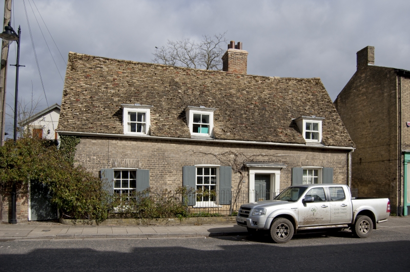
Two cottages, now one, forming an L-plan. The front range was an open-hall, C16, into which the floor and hearth were inserted in C17. In c.1840 the facade was cased in gault brick. Timber framed, plaster rendered with plain tile roof and tall early C18 red and gault brick stack to the side of the ridge. Three bays and now with lobby-entry plan. Three dormers and three recessed hung sashes with glazing bars. c.1840 doorcase of fluted pilasters with plain entablature and dentil cornice. The rear, originally a separate cottage, is C17 and also timber framed and plaster rendered. Plain tile roof with ridge stack. Three bay plan. Interior. Front range has inserted ceiling to the centre bay and small, off-centre inglenook with breadoven. The staircase is at the side of the stack and is early C19. Rear range has abutting inglenook hearths with a breadoven.
Listing NGR: TL5941373118
External links are from the relevant listing authority and, where applicable, Wikidata. Wikidata IDs may be related buildings as well as this specific building. If you want to add or update a link, you will need to do so by editing the Wikidata entry.


Other nearby listed buildings