Latitude: 52.1951 / 52°11'42"N
Longitude: 0.3831 / 0°22'59"E
OS Eastings: 562978
OS Northings: 257882
OS Grid: TL629578
Mapcode National: GBR NBH.7PQ
Mapcode Global: VHJGW.L3D2
Plus Code: 9F4259WM+26
Entry Name: The Guildhall
Listing Date: 25 April 1984
Grade: II*
Source: Historic England
Source ID: 1126323
English Heritage Legacy ID: 49175
ID on this website: 101126323
Location: Dullingham, East Cambridgeshire, CB8
County: Cambridgeshire
District: East Cambridgeshire
Civil Parish: Dullingham
Built-Up Area: Dullingham
Traditional County: Cambridgeshire
Lieutenancy Area (Ceremonial County): Cambridgeshire
Church of England Parish: Dullingham St Mary
Church of England Diocese: Ely
Tagged with: Gildhouse Thatched cottage
TL 65 NW DULLINGHAM STATION ROAD (North Side)
6/97 No. 2 (The Guildhall)
II*
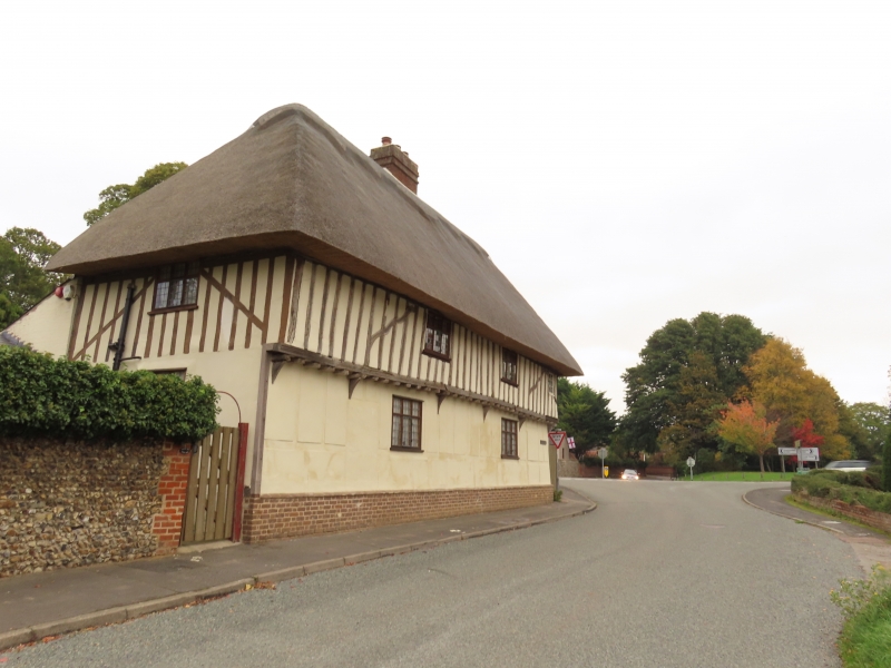
Guildhall to St. James' guild, now a house. Built before 1495. Timber framed, part plastered. Clunch rear outshut. Painted brick foundations. Ripped, thatched roof. Ridge chimney stack rebuilt with three separate rectangular shafts. Two storeys. Timber frame of five bays, jettied, with plastered gable walls and ground floor. Two sealed doorways to street, main entrance resited to rear. Three first floor, and three ground floor three-light casement windows include two with leaded lights. One smaller first floor casement window to right hand. Interior (not seen 1983) has two inglenook hearths; 017 panelling at first floor and some wall painting. Exposed floor frames and roll-moulded beams. Building used as poor house in C18, scratched date of 1717. Report of Commissioners, 1839, p.134. CUL. VCH, Vol. VI, p.167. RCHM (Cambs notes), 1953.
Listing NGR: TL6297857882
External links are from the relevant listing authority and, where applicable, Wikidata. Wikidata IDs may be related buildings as well as this specific building. If you want to add or update a link, you will need to do so by editing the Wikidata entry.


Other nearby listed buildings