Latitude: 51.5867 / 51°35'12"N
Longitude: -0.8717 / 0°52'17"W
OS Eastings: 478270
OS Northings: 188142
OS Grid: SU782881
Mapcode National: GBR C47.GFM
Mapcode Global: VHDW8.VC1Z
Plus Code: 9C3XH4PH+M8
Entry Name: Colstrope Farmhouse
Listing Date: 20 August 1974
Grade: II
Source: Historic England
Source ID: 1125717
English Heritage Legacy ID: 46710
ID on this website: 101125717
Location: Pheasant's Hill, Buckinghamshire, RG9
County: Buckinghamshire
Civil Parish: Hambleden
Traditional County: Buckinghamshire
Lieutenancy Area (Ceremonial County): Buckinghamshire
Church of England Parish: Hambleden with Frieth
Church of England Diocese: Oxford
Tagged with: Farmhouse
SU 78 NE HAMBLEDEN COLSTROPE
6/60 Colstrope Farmhouse 20.8.74
GV II
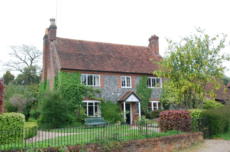
House. Early - mid C18. Knapped flint to front, with brick dressings and dentil eaves; remainder brick with incised line pointing. Plain tile M roof with flanking brick chimneys. Double pile. 2 storeys, cellar and attics; 3 bays. Outer bays have 3-light windows with central metal casements and C20 glazing, the ground floor left window altered with top lights. Both ground floor windows have segmental heads. 2-light window to centre over half-glazed door in C20 gabled wooden porch. Small lower wing to right. Rear has 3-light windows to outer bays, c.1830-40 French doors with arched trellis porch to right, and central staircase window. C20 casement inserted to ground floor right. Small attic casements in gables. Interior: entrance hall has reeded doorcases; rear parlour has similar doorcases with rosettes at corners, and small marble fireplace, all of c,1830-40; front left room has asymmetrical arched recesses flanking altered fireplace. Lower wing has queen strut trusses incorporating timbers from older structure.
Listing NGR: SU7827088142
External links are from the relevant listing authority and, where applicable, Wikidata. Wikidata IDs may be related buildings as well as this specific building. If you want to add or update a link, you will need to do so by editing the Wikidata entry.


Other nearby listed buildings