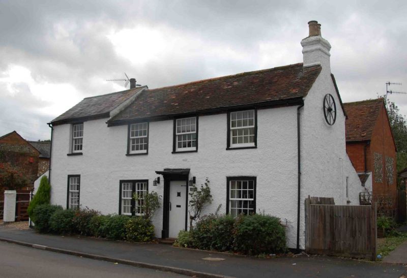
Latitude: 51.6174 / 51°37'2"N
Longitude: -0.7176 / 0°43'3"W
OS Eastings: 488883
OS Northings: 191728
OS Grid: SU888917
Mapcode National: GBR D5C.KCW
Mapcode Global: VHDW5.HLZZ
Plus Code: 9C3XJ78J+WX
Entry Name: 42, Beech Road
Listing Date: 28 June 1973
Grade: II
Source: Historic England
Source ID: 1125211
English Heritage Legacy ID: 45969
ID on this website: 101125211
Location: Wycombe Marsh, Buckinghamshire, HP11
County: Buckinghamshire
Parish: Non Civil Parish
Built-Up Area: High Wycombe
Traditional County: Buckinghamshire
Lieutenancy Area (Ceremonial County): Buckinghamshire
Church of England Parish: High Wycombe Saint Anne and Saint Peter
Church of England Diocese: Oxford
Tagged with: Building
1.
963
SU 8891 NE
4/221
BEECH ROAD
No 42
II
C18 with C19 south wing. Colour washed pebbledash, tiled roof. 2 storeys,
Velsh slate roof to south wing of 1 window 4 sashes with glazing bars ;
door surround, cut bracketed hood.
Listing NGR: SU8888391728
External links are from the relevant listing authority and, where applicable, Wikidata. Wikidata IDs may be related buildings as well as this specific building. If you want to add or update a link, you will need to do so by editing the Wikidata entry.


Other nearby listed buildings