Latitude: 51.5725 / 51°34'21"N
Longitude: -0.5003 / 0°30'1"W
OS Eastings: 504027
OS Northings: 187026
OS Grid: TQ040870
Mapcode National: GBR 07.QJK
Mapcode Global: VHFSY.8QVW
Plus Code: 9C3XHFFX+2V
Entry Name: Misbourne Cottage
Listing Date: 23 September 1955
Grade: II
Source: Historic England
Source ID: 1124429
English Heritage Legacy ID: 43999
ID on this website: 101124429
Location: Denham, Buckinghamshire, UB9
County: Buckinghamshire
Civil Parish: Denham
Built-Up Area: Denham
Traditional County: Buckinghamshire
Lieutenancy Area (Ceremonial County): Buckinghamshire
Church of England Parish: Denham
Church of England Diocese: Oxford
Tagged with: Cottage
TQ 0487 DENHAM VILLAGE ROAD (south side) 15/387 Misbourne Cottage 23.9.55 GV II
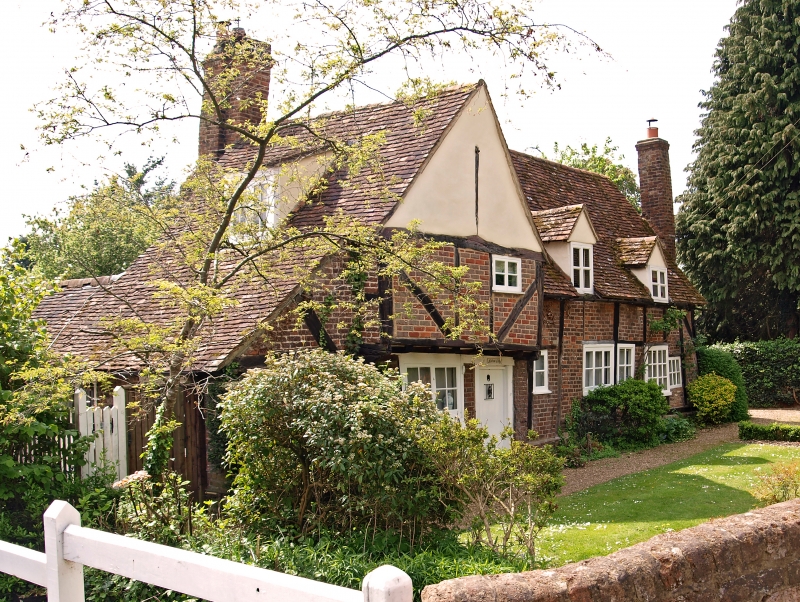
C16 or C17, altered. Timber-framed; brick nogging; hand made tile roof. One storey and attic. Left-hand gable rendered. First floor with one small 2-light casement and 2 dormer windows. Ground floor with boarded door and one 2-light casement. On left-hand, roof slopes to cover one storey addition. On right hand, one small casement, one 3-light casement, one fixed window, one 2-light casement and one fixed window. Set back, on the right, a single-storeyed modern addition.
Listing NGR: TQ0403087027
External links are from the relevant listing authority and, where applicable, Wikidata. Wikidata IDs may be related buildings as well as this specific building. If you want to add or update a link, you will need to do so by editing the Wikidata entry.


Other nearby listed buildings