Latitude: 51.7059 / 51°42'21"N
Longitude: 0.1192 / 0°7'9"E
OS Eastings: 546528
OS Northings: 202924
OS Grid: TL465029
Mapcode National: GBR LF9.T54
Mapcode Global: VHHMM.0DW2
Plus Code: 9F32P449+9M
Entry Name: Forest Lodge
Listing Date: 7 November 1949
Grade: II
Source: Historic England
Source ID: 1124151
English Heritage Legacy ID: 117594
ID on this website: 101124151
Location: Epping Forest, Essex, CM16
County: Essex
District: Epping Forest
Civil Parish: Epping
Built-Up Area: Epping
Traditional County: Essex
Lieutenancy Area (Ceremonial County): Essex
Church of England Parish: Epping St John
Church of England Diocese: Chelmsford
Tagged with: Gatehouse
1. 1085 THE PLAIN HARLOW ROAD
Forest Lodge TL 40 SE 2/21 7.11.49.
II
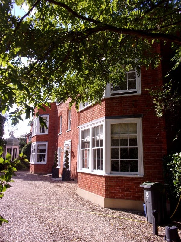
2. Early cottage enlarged to house late C18 (Rain water head 1787) with later period additions. 2 storeys, bay-3-bay windows, brick facade, parapet (dropped in centre), flat arches. Sashes in reveals, ends have 4-unit bays. Later slate roof.
Listing NGR: TL4652802924
External links are from the relevant listing authority and, where applicable, Wikidata. Wikidata IDs may be related buildings as well as this specific building. If you want to add or update a link, you will need to do so by editing the Wikidata entry.


Other nearby listed buildings