Latitude: 51.8434 / 51°50'36"N
Longitude: 0.6792 / 0°40'45"E
OS Eastings: 584655
OS Northings: 219483
OS Grid: TL846194
Mapcode National: GBR QKS.BKJ
Mapcode Global: VHJJL.QXFQ
Plus Code: 9F32RMVH+9M
Entry Name: Felix Hall
Listing Date: 10 April 1987
Grade: II
Source: Historic England
Source ID: 1123797
English Heritage Legacy ID: 116532
ID on this website: 101123797
Location: Braintree, Essex, CO5
County: Essex
District: Braintree
Civil Parish: Kelvedon
Traditional County: Essex
Lieutenancy Area (Ceremonial County): Essex
Church of England Parish: Kelvedon St Mary the Virgin
Church of England Diocese: Chelmsford
Tagged with: Building
KELVEDON HOLLOW ROAD TL 81 NW (north side)
5/235 Felix Hall 10.4.87
GV II
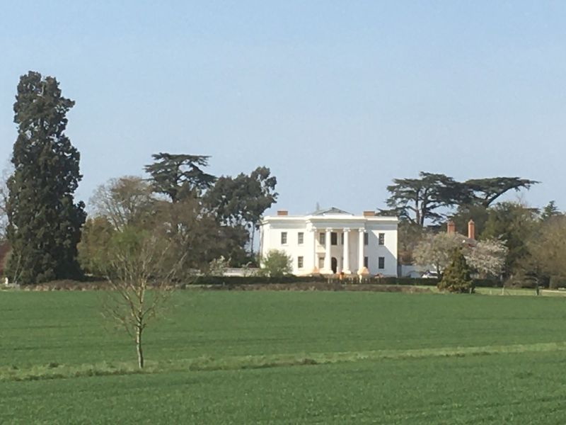
Mansion. C18, reduced in size in 1939, severely damaged by fire in 1940. Red brick in Flemish bond, formerly stuccoed, now mainly exposed, unroofed. Rectangular range facing SE. 2 storeys and basement. SE elevation, 2:3:2 window range of open apertures. Large tetrastyle Ionic portico and 10 stone steps. Open entrance with 2 engaged columns and 2 pilasters, entablature and pediment. Above it, 3 window apertures divided by engaged Ionic columns, and 2 pilasters. NW (garden) elevation, ground floor, 3 sashes of 6 lights and 2 blocked apertures. First floor, 2:5:2 window range of open apertures; the middle window has stone jambs and semi-circular head. Blocked central doorway with stone doorcase and shallow canopy. 2 engaged giant columns, 2 giant pilasters, and pediment with blank panel. 6 plain stone steps and 2 semi-circular stone steps with moulded lips. One blocked basement window aperture to each side of steps. Walls extend to left and right, representing the basement storey of the wings demolished in 1939, each with 2 blocked window apertures and a plain stone band. Part of the ground floor and basement at the NE end are occupied as a house, with a flat roof. Built c.1715 for Sir Anthony Abdy, enlarged c.1750 for Charles Callis Western. Wings demolished in 1939 by Geoffrey Houghton Brown (B.L. Kentish, Kelvedon and its Antiquities, 1974, 28-30; Plate 1 is a photograph taken in 1865 from the E). Other photographs taken c.1865 from the E and NW are reproduced in Simon Houfe, 'A Household Preserved', Country Life, 27 May 1976, 1430. An engraving of the house from the E in 1832 is reproduced in Virtue's Picturesque Beauties of Great Britain, 1833, 56.
Listing NGR: TL8465519483
External links are from the relevant listing authority and, where applicable, Wikidata. Wikidata IDs may be related buildings as well as this specific building. If you want to add or update a link, you will need to do so by editing the Wikidata entry.


Other nearby listed buildings