Latitude: 53.3596 / 53°21'34"N
Longitude: -1.8202 / 1°49'12"W
OS Eastings: 412060
OS Northings: 384763
OS Grid: SK120847
Mapcode National: GBR HYQL.QD
Mapcode Global: WHCCD.0THB
Plus Code: 9C5W955H+RW
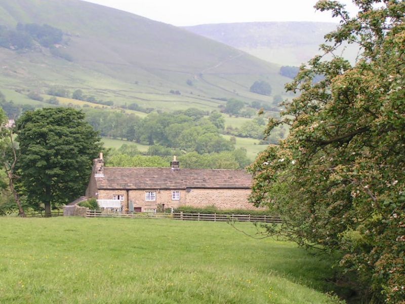
Entry Name: Small Clough Farmhouse and Attached Barn
Listing Date: 24 September 1984
Grade: II
Source: Historic England
Source ID: 1122656
English Heritage Legacy ID: 82507
ID on this website: 101122656
Location: Edale, High Peak, Derbyshire, S33
County: Derbyshire
District: High Peak
Civil Parish: Edale
Traditional County: Derbyshire
Lieutenancy Area (Ceremonial County): Derbyshire
Church of England Parish: Edale Holy and Undivided Trinity
Church of England Diocese: Derby
Tagged with: Farmhouse
PARISH OF EDALE EDALE ROAD SK 18 SW 6/47 (South Side) Small Clough Farmhouse and attached barn II Farmhouse and attached barn. C17 altered c19. Coursed gritstone with gritstone dressings. Stone slate roof with brick ridge stack and gable end stack. Two storeys, angle quoins. South elevation - house to left, three bays. Off centre doorway with plank door. 3-light recessed and chamfered mullion window to the left with similar 3-light windows above. To the right, a former 3-light mullioned window enlarged in C19 with casement lights, The recessed and chamfered lintel and right hand jamb remain. Window above with recessed and chamfered surround, raised in height and with C19 casement window set in. To the right, a window set within a former doorway with chamfered lintel and quoins. Casement window above. Barn attached to the right, slightly set back, with single doorway and single window opening.
Listing NGR: SK1206084763
External links are from the relevant listing authority and, where applicable, Wikidata. Wikidata IDs may be related buildings as well as this specific building. If you want to add or update a link, you will need to do so by editing the Wikidata entry.


Other nearby listed buildings